COLUMBIA, S.C. — High pressure will continue to build in behind yesterday’s cold front. Dry weather will carry us through Tuesday, and temperatures will moderate. Active weather returns to the area Wednesday as another cold front approaches the area. Showers may continue through early Thursday.
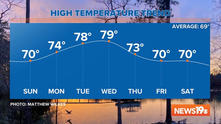
Today will be sunny and breezy. Winds will be out of the northwest at 5-10 mph. Temperatures will be near seasonable, topping off in the upper 60s and lower 70s later today. The average high this time of the year is 69 degrees.
Monday morning will be clear and cool. Lows will be in the upper 30s and lower 40s to start off the new workweek.

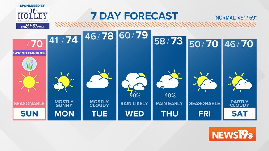
Monday will be mostly sunny and a little warmer. High temperatures will be in the lower to middle 70s. It will be mostly clear Monday night and temperatures will fall into the middle to upper 40s.
The clouds build into the area Tuesday. Highs will be in the upper 70s. Tuesday should be dry, but the moisture will continue to move into the area.
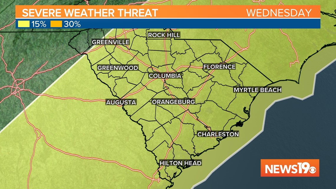
Unsettled weather is expected to return to the area Wednesday. The Storm Prediction Center has the Midlands under a risk for severe weather Wednesday and Wednesday night.
It is still too soon to know the timing or the type of severe weather, but it appears the threat will be there.

Showers will end early Thursday morning. Clouds will decrease throughout the day. Highs will be in the lower 70s.
Friday and Saturday will be partly cloudy. Highs will be in the upper 60s and lower 70s.

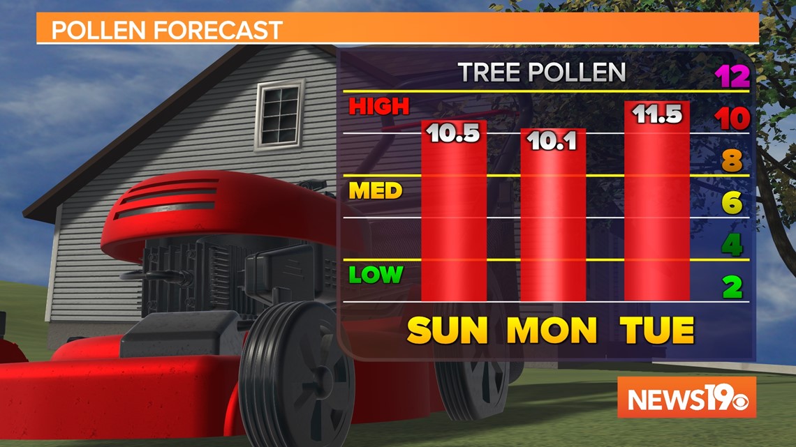
Pollen levels will continue to be high over the next several days, but by Wednesday the pollen count should drop a little.