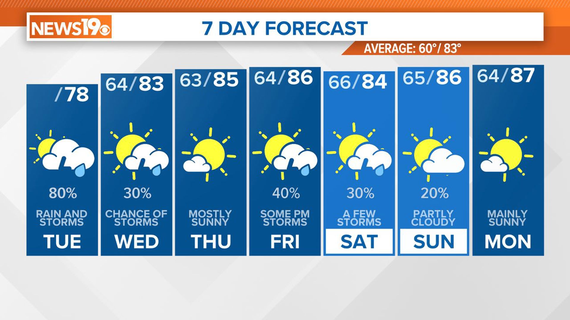
COLUMBIA, S.C. — Dry, warm conditions will continue through the week and into the weekend. Temperatures will be heating up over the weekend and into next week with little chance for any rain. We are also tracking the tropics. A system in the Atlantic now has a high chance of further development over the next five days, according to the National Hurricane Center.
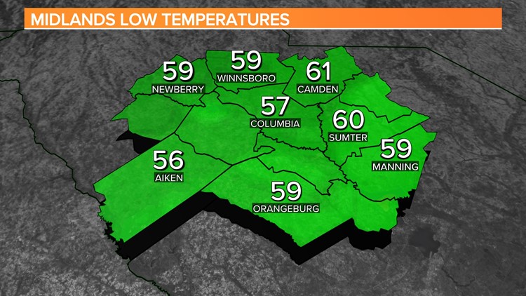
Wednesday start off clear and cooler than normal. Lows dropped into the upper 50s and lower 60s for most of the Midlands. The Columbia airport reported a low of 57 degrees. This morning was the first time we have been in the 50-degree range in Columbia since June 20.

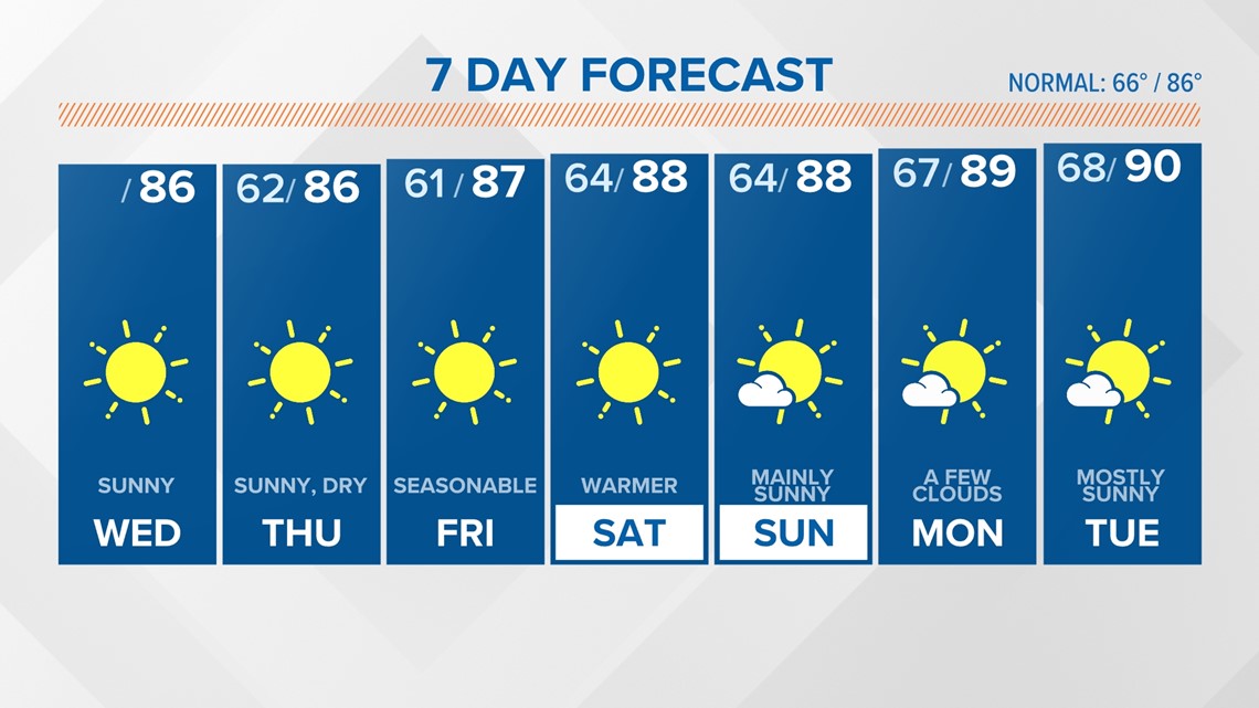
This afternoon will be sunny and seasonable with highs in the middle 80s. Overnight will be clear and on the cool side again. Lows will be in the upper 50s to lower 60s Thursday morning.
The warm, dry weather will continue through the workweek and into the weekend. Highs over the weekend will be in the upper 80s. We may make it to near 90 for the start of the workweek.
Tracking the Tropics:
Showers and thunderstorms have increased a little during the past several hours in association with a tropical wave located a little less than 800 miles east of the Lesser Antilles.
Even though environmental conditions are only slightly conducive, some additional development of this system is possible, and a tropical depression could form during the next couple of days.

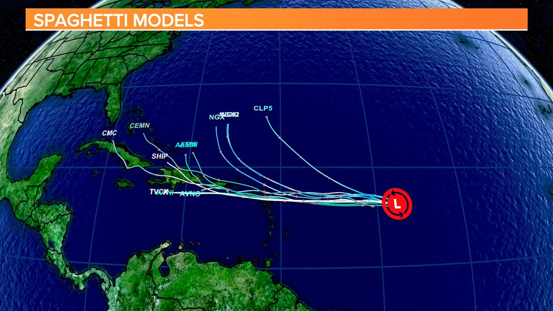
This system is expected to move west to west-northwest. It is forecast to be near the Leeward Islands on Friday. Interests in the Leeward Islands, the Virgin Islands, and Puerto Rico should monitor the progress of this system.
The National Hurricane Center now gives this area a 70% chance of further development over the next five days.