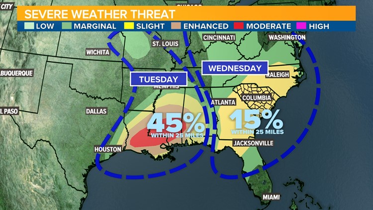
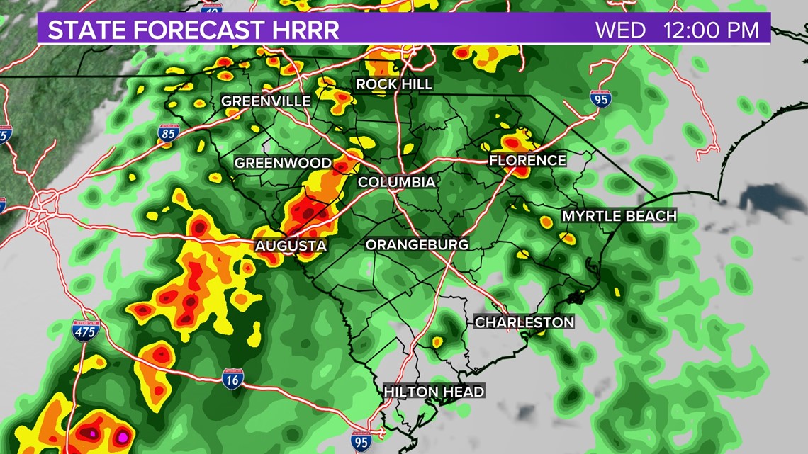
COLUMBIA, S.C. — Rain is expected in the Midlands on Wednesday and a few communities may see strong storms with damaging wind. This week, the Storm Prediction Center placed the entire state of South Carolina under a Slight Risk (Level 2 out of 5) for severe thunderstorms capable of producing damaging wind on Wednesday. This risk level means there is a 15% chance of severe weather occurring within 25 miles of your community.


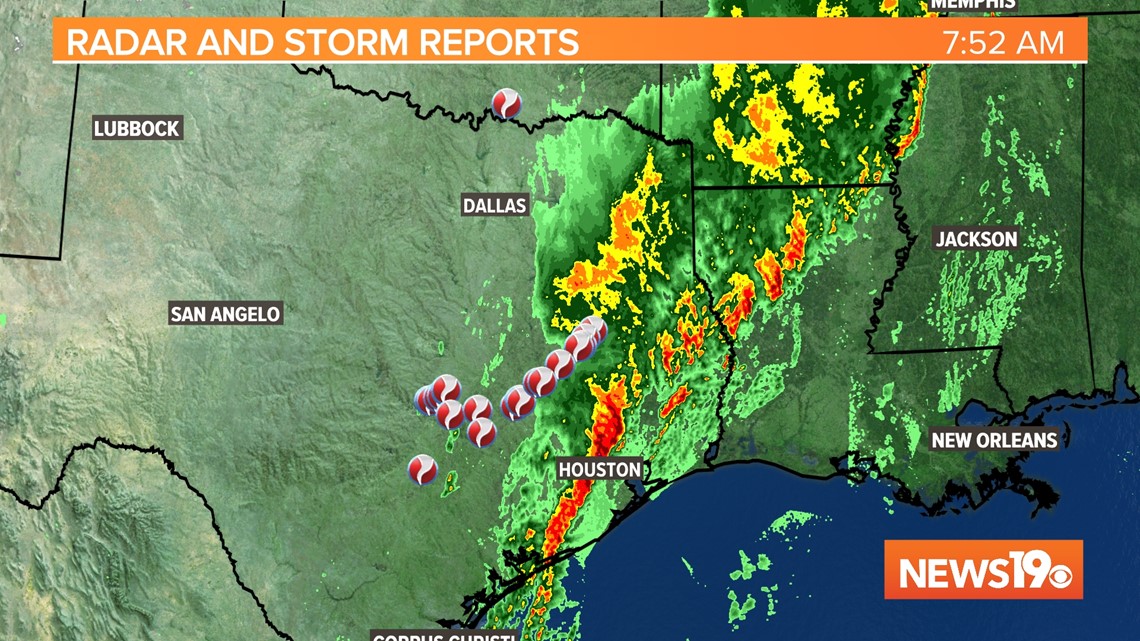
On Tuesday morning, an area of low pressure and strong upper level jet of winds aloft were producing torrential rain in eastern Texas after a night of numerous severe storms and tornadoes. As of 7 AM on Tuesday morning, the National Weather Service had compiled more than 20 reports of tornado damage in eastern Texas and numerous hail and reports of straight line wind damage.

This storm system will sweep into Louisiana and Mississippi where conditions are even more favorable for tornadic activity on Tuesday afternoon. The storm system will begin to pull northward on Wednesday, so the upper level support for severe weather is not as intense in South Carolina or the Mid Atlantic on Wednesday; however, there’s enough energy in the upper levels of the atmosphere to support scattered strong storms. The primary risk would be for straight line winds, but a tornado cannot be ruled out from Virginia to Georgia on Wednesday and some hail is also possible.
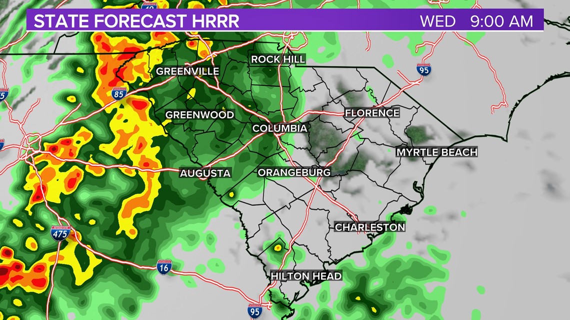
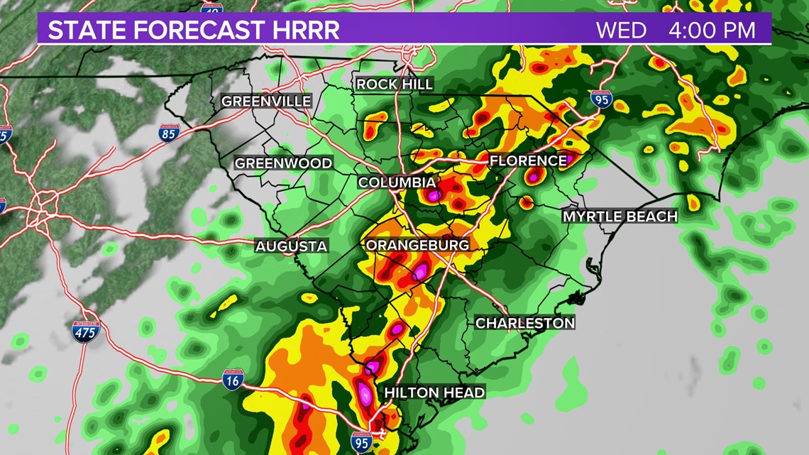
Another concern on Wednesday will be heavy rain, particularly in the South Carolina Upstate and western Midlands. The Weather Prediction Center has issued a marginal risk for flash flooding from strong storms on Wednesday which translates to a 5% chance within 25 miles of your community. Up to an inch of rain is possible with some storms on Wednesday.
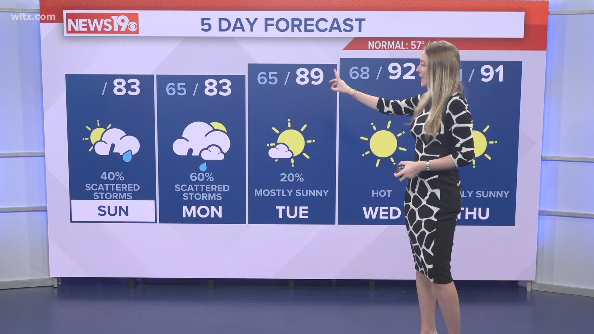
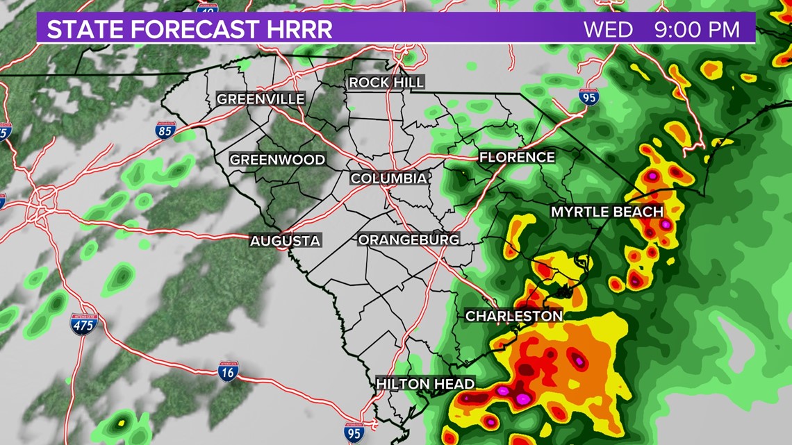
Tuesday will be dry in the Midlands with warm temperatures and a mix of clouds and sunshine. Rain should also hold off for Tuesday overnight into the early Wednesday morning commute, but the risk for showers will increase by 7 am on Wednesday. The greatest risk for severe weather will start mid morning on Wednesday and continue into mid-afternoon. Rain will begin to taper off early in the evening around dinnertime, although showers will return for the eastern half of the state on Thursday morning.


At this time, widespread severe weather is not expected during this event in the Midlands, but be prepared for any watches and warnings that could be issued on Wednesday.