COLUMBIA, S.C. — A tornado watch has been issued for the entire Midlands Wednesday as a change of severe storms will be present through the mid-afternoon.
The watch is for the following counties and is in effect until 2 p.m. Eastern: Calhoun, Clarendon, Fairfield, Newberry, Orangeburg, Saluda, Kershaw, Lee, Richland, Lexington, and Sumter.
A watch means conditions are favorable for that type of weather, which in this case would be a tornado. A tornado warning would mean that a tornado has actually been indicated on radar or spotted by someone on the ground.
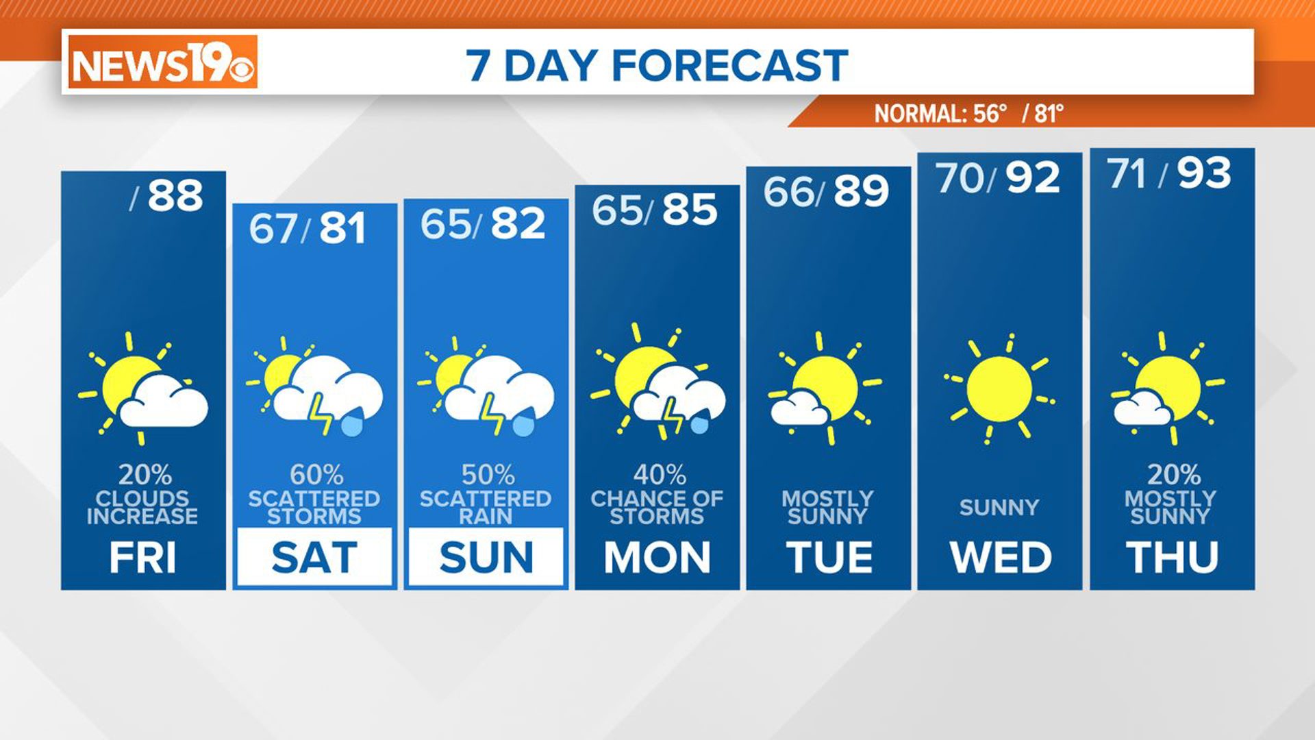
After seeing high temperatures around 10 to 15 degrees above average the last few days, it has really felt like spring here across the Midlands. That spring warmth will result in the chance of some thunderstorms as we go tonight and into the first half of Wednesday.
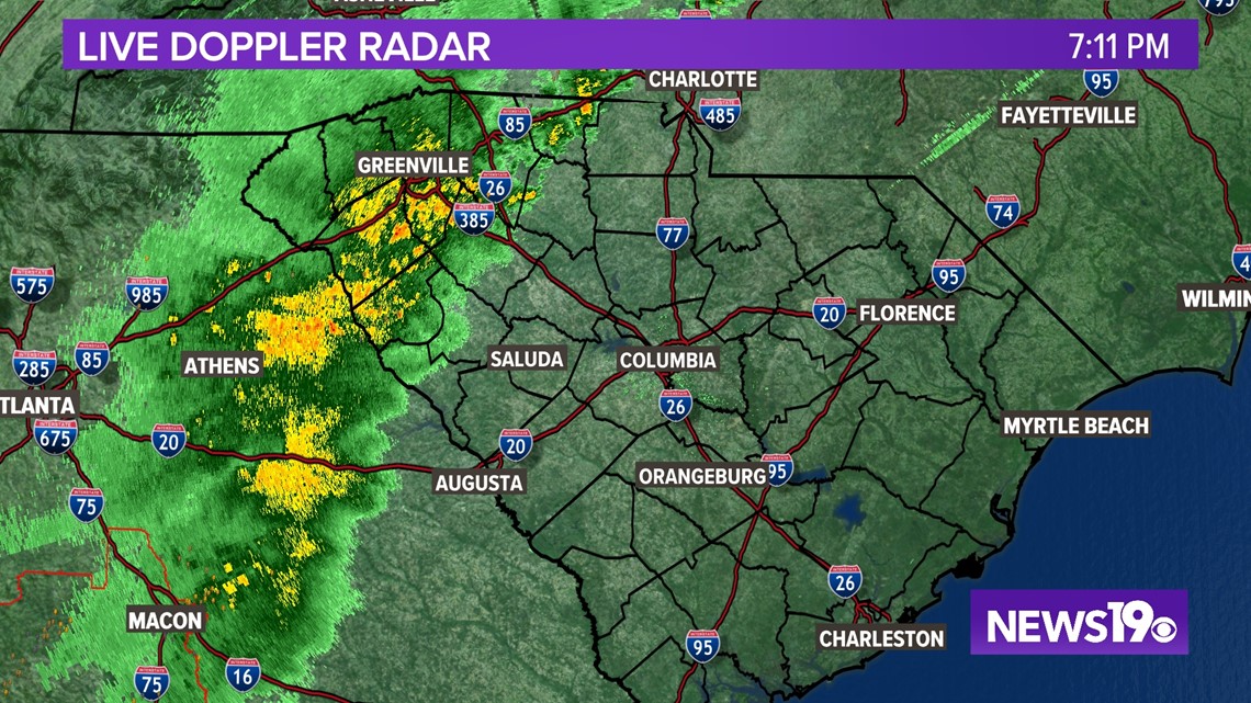
Tuesday night we are tracking storms moving out of Georgia and into the upstate of South Carolina. The storms are thankfully weakening so as of right now we are expecting just some heavy rain and thunder to move into the Midlands starting around 9 PM and lasting through around 1 AM in the morning. With this round of rain, expect a good soaking and some thunder but no severe weather is expected.

We will continue to see the chance of scattered downpours overnight but, rain chances will be a bit lower during this period.
From there we turn our attention to the late morning hours of Wednesday.
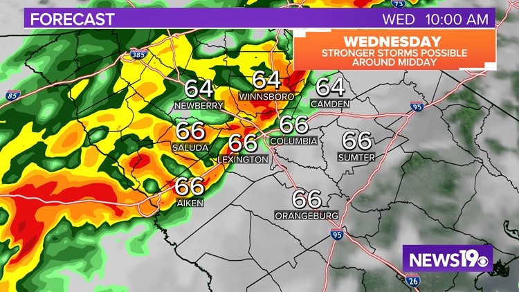
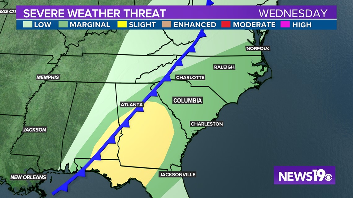
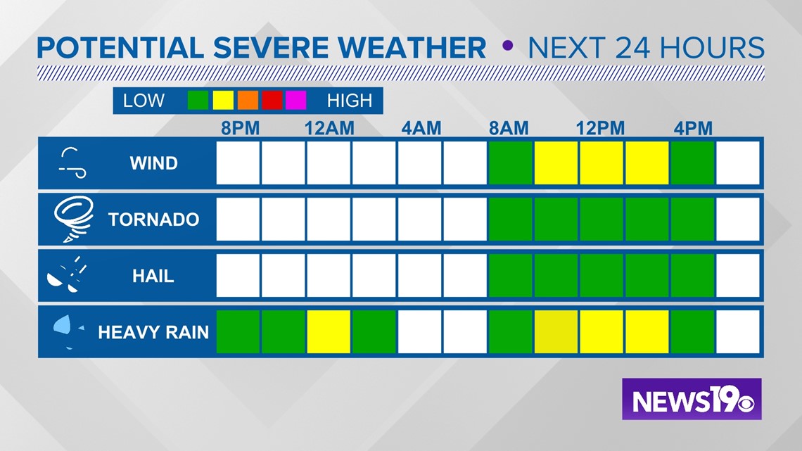
The Storm Prediction Center has included the Midlands in a Marginal (Level 1 out of 5) risk for Wednesday due to the threat of some isolated severe weather.

Around 8 AM the cold front responsible for all of this stormy weather will begin to advance into the Carolinas. This will bring another round of storms during this period. Thanks to the warm air we will have plenty of energy in place from storms. With wind shear also in place some of these storms could become severe.


The time frame for this line looks to be mainly 8 AM to 1 PM with some storms possible through 4PM.
Damaging winds will be the biggest concern but we cannot rule out a stray tornado or some large hail with these storms.

As we get into the afternoon and evening any rain in the area should begin to move out as drier conditions move in for the rest of the week.