
COLUMBIA, S.C. — Idalia is now a category 2 storm as of Tuesday afternoon in the Gulf of Mexico. The storm is forecast to become a major hurricane before making landfall along the western coast of Florida on Wednesday.
The stage is set for Idalia to rapidly intensify before making landfall. As an upper-level trough departs the northeastern Gulf of Mexico and ridging builds closer to the cyclone, shear should continue to decrease over it. These changes, combined with the hurricane's passage through extremely warm and deep waters, all point to rapid intensification.
The maximum sustained wind speed has risen to near 85 mph, with higher gusts. Idalia is expected to rapidly intensify as it approaches land, and it is expected to become an extremely dangerous major hurricane before making landfall on Wednesday.

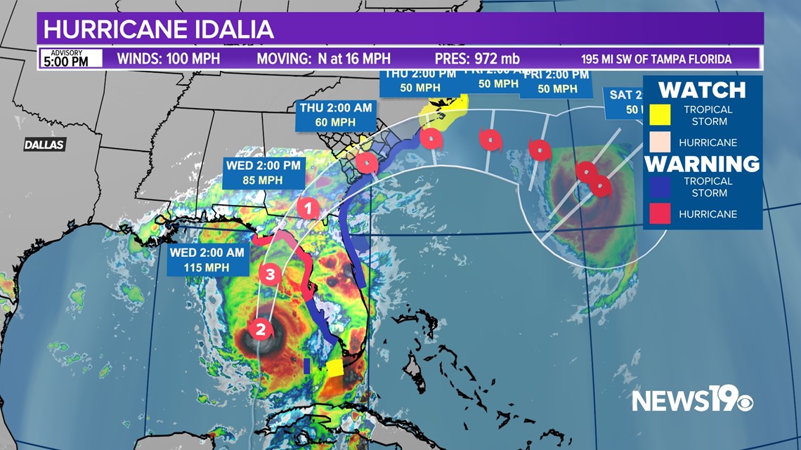
The new forecast is similar to the previous one, and there is growing confidence that an extremely dangerous major hurricane will make landfall Wednesday along Florida's west coast or Big Bend region bringing up to 15 feet of storm surge.
South Carolina Impacts:
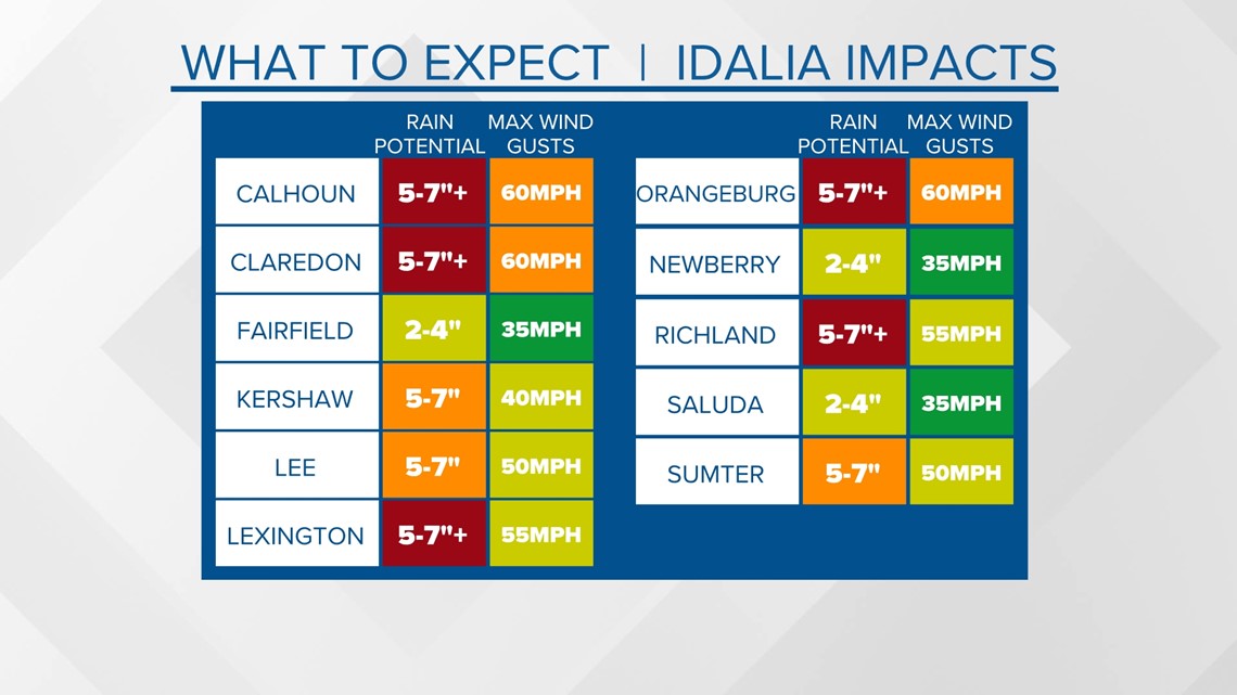
Before getting into all of the details, here is what we are currently expecting by county here in the Midlands. Rain will be by far the biggest concern potentially leading to flooding. Winds will be strong enough to cause some power outages.

Hurricane warnings and Tropical Storm warnings are out for portions of the South Carolina coast and Lowcountry. Tropical storm watches have been issued for the southern Midlands although this may change if the current storm track changes.


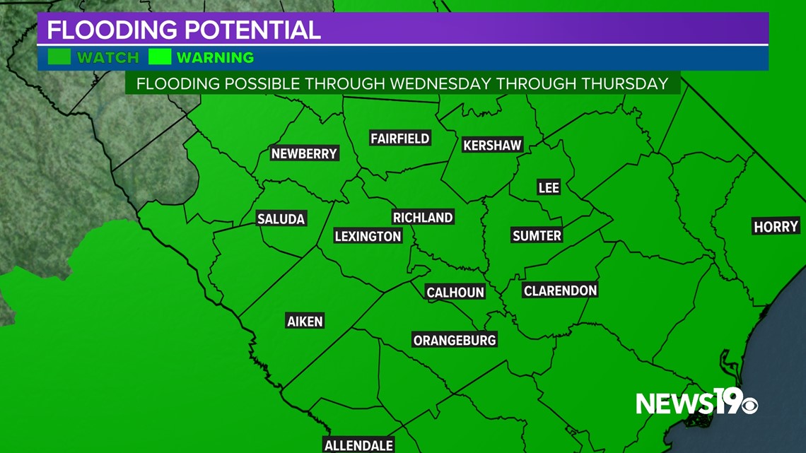
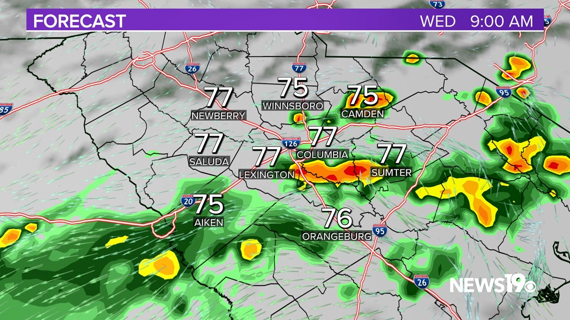
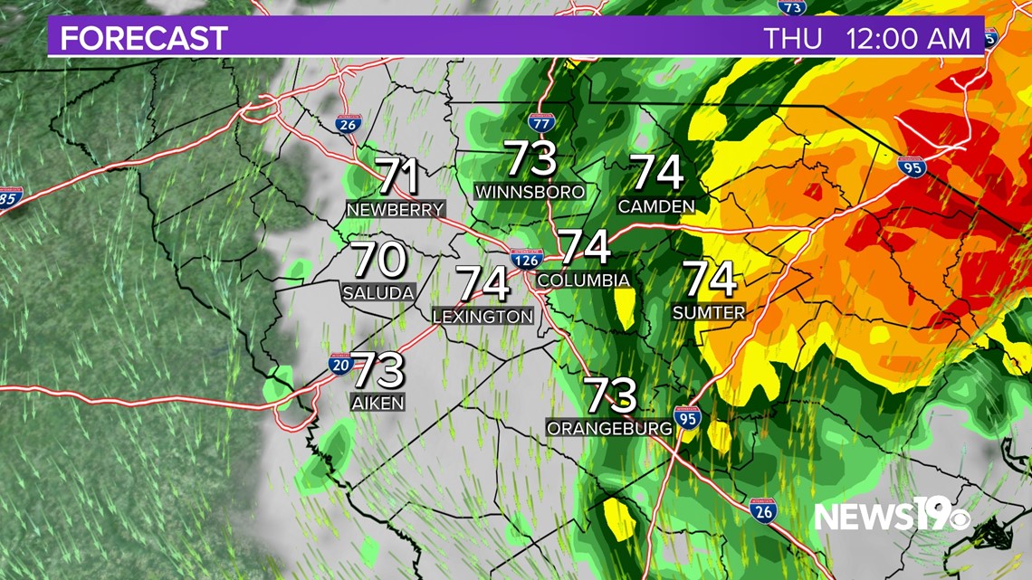
Hurricane Idalia will pass through the forecast area on Wednesday and early Thursday. Strong and gusty winds and heavy rainfall are expected to have the greatest impact in the central and eastern Midlands and the southern CSRA, resulting in the possibility of widespread flooding.
The primary threat for the forecast area remains heavy rain and associated flooding. Forecast rainfall amounts in the Central and Eastern Midlands and lower CSRA are now in the 5-7 inch range, with locally higher amounts. Lower amounts are expected further inland. Flood Watches have already been issued by the National Weather Service for the entire viewing area.


As a result, the Weather Prediction Center has issued a moderate risk (level 3 of 4) for excessive rainfall in the Central and Eastern Midlands, with a slight risk (level 2 of 4) for the rest of the region. It is important to note that the forecast track and intensity can still change, resulting in a slight change in impacts, particularly the location.


Tornadoes are also possible, primarily in the eastern Midlands. The Storm Prediction Center has parts of the state under a slight risk (level 2 of 5) of severe weather, mainly along and east of I-95.
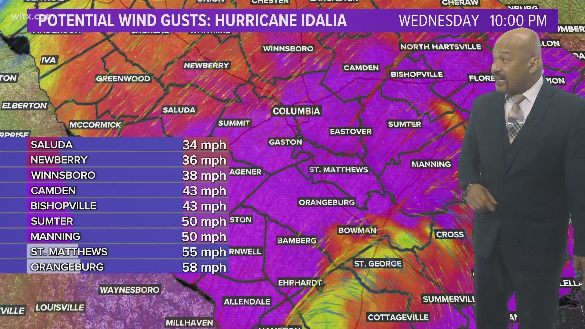
Moving on to wind, tropical storm sustained winds will likely only be found in Clarendon, Orangeburg, Calhoun and Sumter counties. As of right now, tropical storm wind gusts will be likely across a good portion of the region Wednesday afternoon and evening.


Timeline:
9 AM Wednesday

6 PM Wednesday


7 PM Wednesday


12 AM Thursday

Drier air is forecast to move in behind Idalia. This will limit the chance for rain through the holiday weekend. Temperatures will gradually warm through Monday.