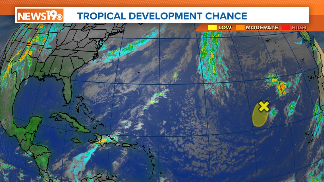
COLUMBIA, S.C. — An area of low pressure located approximately 900 miles northwest of the Cabo Verde Islands has been generating a limited yet consistent region of showers and thunderstorms east of its core since Wednesday.
However, forecasters predict that the low will track southwestward at speeds ranging from 10 to 15 mph and will move into an area characterized by stronger upper-level winds tonight and continuing into tomorrow. Any further intensification of the system is not anticipated over the next few days.
No additional special tropical weather outlooks are slated for this particular system unless conditions change.
The routine issuance of tropical weather outlooks is scheduled to start on May 15, 2024. Meanwhile, special tropical weather outlooks will be issued as deemed necessary throughout the remainder of the off-season.

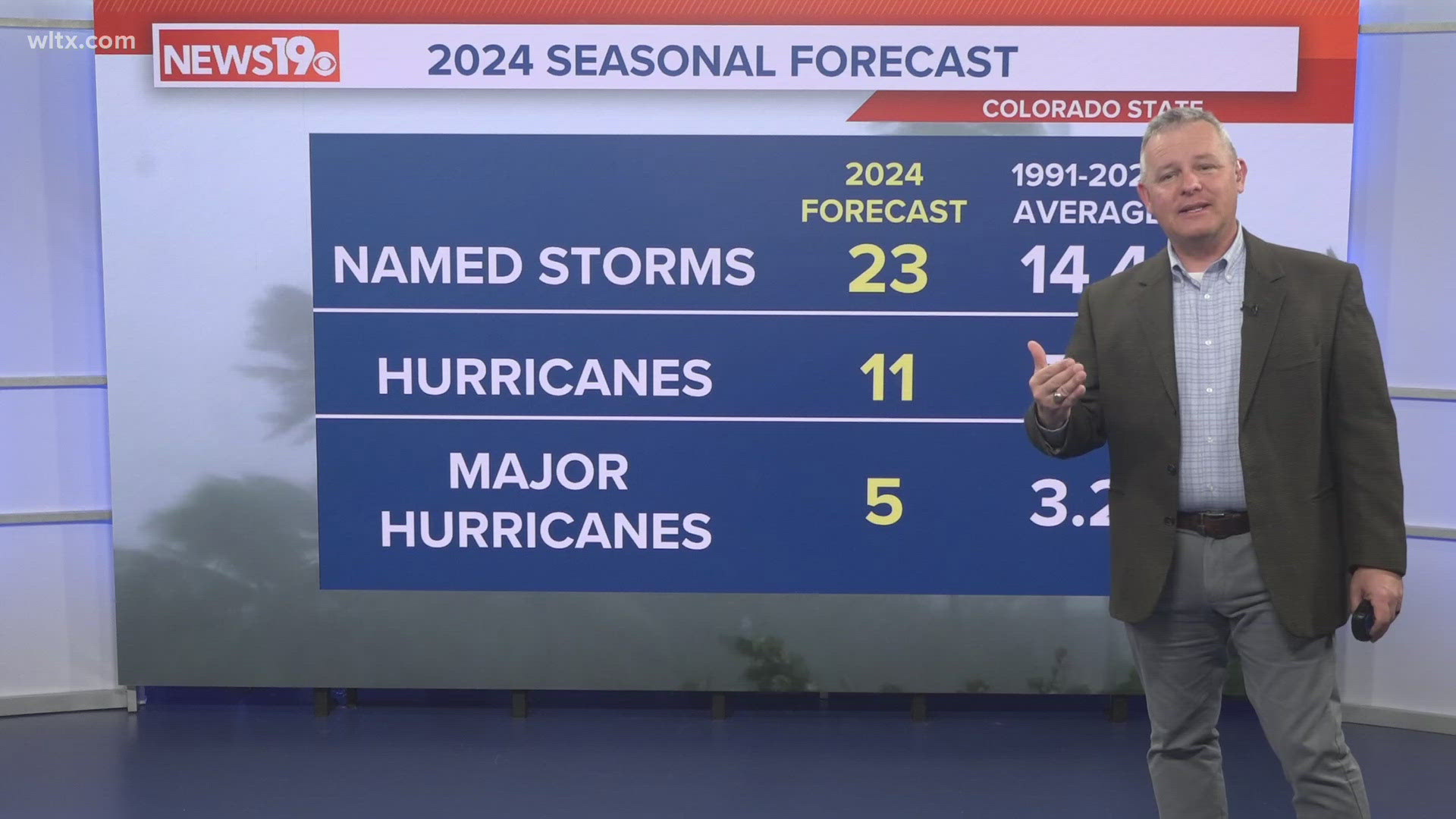
Off-season tropical development alone does not necessarily indicate an exceptionally active year. But when you consider the forecast from Colorado State University that says there will likely be a lot of tropical activity this year, it makes it seem more likely that 2024 will be a busy hurricane season.
According to the CSU team's forecast, 23 named storms are forecast, with 11 expected to intensify into hurricanes and five potentially reaching major hurricane status, characterized by winds of at least 111 mph.

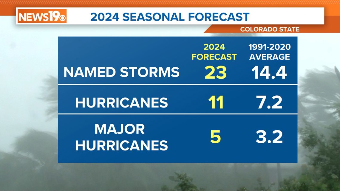
Forecasters highlighted that this outlook marks the largest prediction for named storms ever issued by CSU.
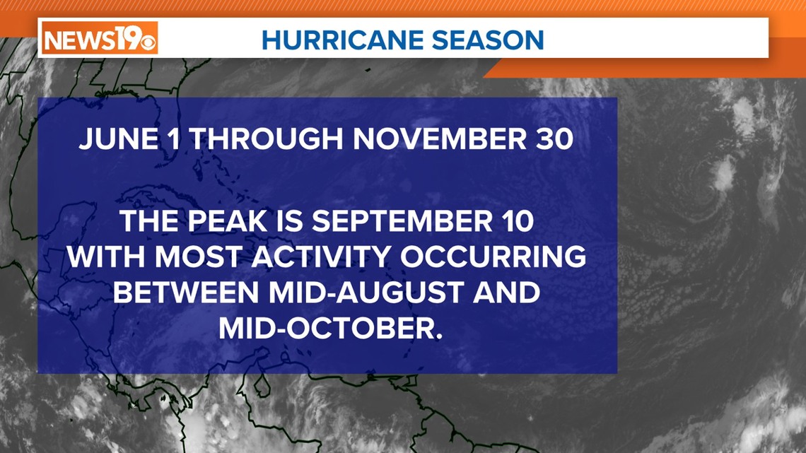
In the Atlantic basin, hurricane season begins on June 1, with the average onset of the first development typically occurring around June 20. The first named tropical system of the 2024 season will be called Alberto.