
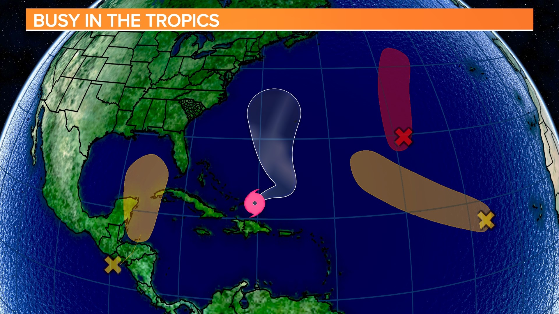
COLUMBIA, S.C. — The National Hurricane Center is issuing advisories on Tropical Storm Franklin, located just east of the Turks and Caicos. The NHC is also tracking three other areas in the tropics for potential tropical development.
Tropical Storm Franklin
Franklin appears to be gaining strength as the system moves away from the Dominican Republic and Turks and Caicos. Deep convection is increasing near and to the east of the center, according to satellite images, and the Air Force Hurricane Hunters reported a partial eyewall developing on their last pass through the storm.
The storm appears to be gradually strengthening, and this is expected to continue through the weekend as the storm remains over warm waters, in a moist environment, and with moderate wind shear. Franklin will reach hurricane strength in a few days, according to all of the normally accurate intensity models, and the NHC intensity forecast follows suit.
There are no coastal watches or warnings in effect for Franklin.


Northwestern Caribbean Sea
In a few days, a low pressure area could form over the northwestern Caribbean Sea. This system may develop gradually over the weekend and early next week, and a tropical depression could form while it moves slowly northward across the eastern Gulf of Mexico.
Next week, we will have to keep a close eye on this system. The European model is developing and moving over Florida, whereas the American model is not yet on board with this system.


The NHC gives this a medium chance of further development over the next several days.
Eastern Tropical Atlantic
Showers and thunderstorms continue to accompany a low pressure system located several hundred miles west of the Cabo Verde Islands. Despite the poor weather, the low could develop into a tropical depression by the weekend as it moves west-northwestward to northwestward into the central tropical Atlantic.
Central Subtropical Atlantic
An area of low pressure located about 1000 miles east-southeast of Bermuda (the remnants of former Tropical Storm Emily) continues to produce a large area of disorganized showers and thunderstorms. Upper-level winds are expected to become more favorable for development later today, and this system is expected to regenerate into a tropical storm by Friday as it moves northward over the subtropical central Atlantic.