
COLUMBIA, S.C. — The National Hurricane Center is monitoring three more tropical waves in the Atlantic for potential development.
The area with the highest odds of development is off the coast of west Africa. It is expected to merge with another disturbance a couple of hundred miles south of the Cabo Verde Islands.
Development of this system is likely to be slow during the next couple of days while it moves west-northwest at about 15 mph. A tropical depression is more likely to form early next week over the central tropical Atlantic.
The NHC gives this tropical wave a 70% of further development over the next five days.

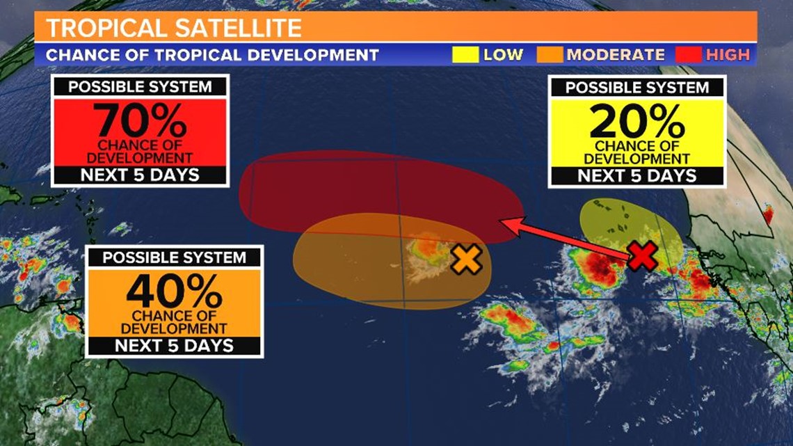
The second area being watched is in the eastern tropical Atlantic several hundred miles west-southwest of the Cabo Verde Islands. It is producing a small area of disorganized showers and thunderstorms. Gradual development is possible early next week.
The NHC gives this tropical wave a 40% of further development over the next five days.
The third area being monitor by the NHC is forecast to move off the west coast of Africa over the weekend. An area of low pressure is expected to form from this wave. Some development of this low will be possible early next week as it moves generally west over the far eastern tropical Atlantic
The NHC gives this tropical wave a 20% of further development over the next five days.
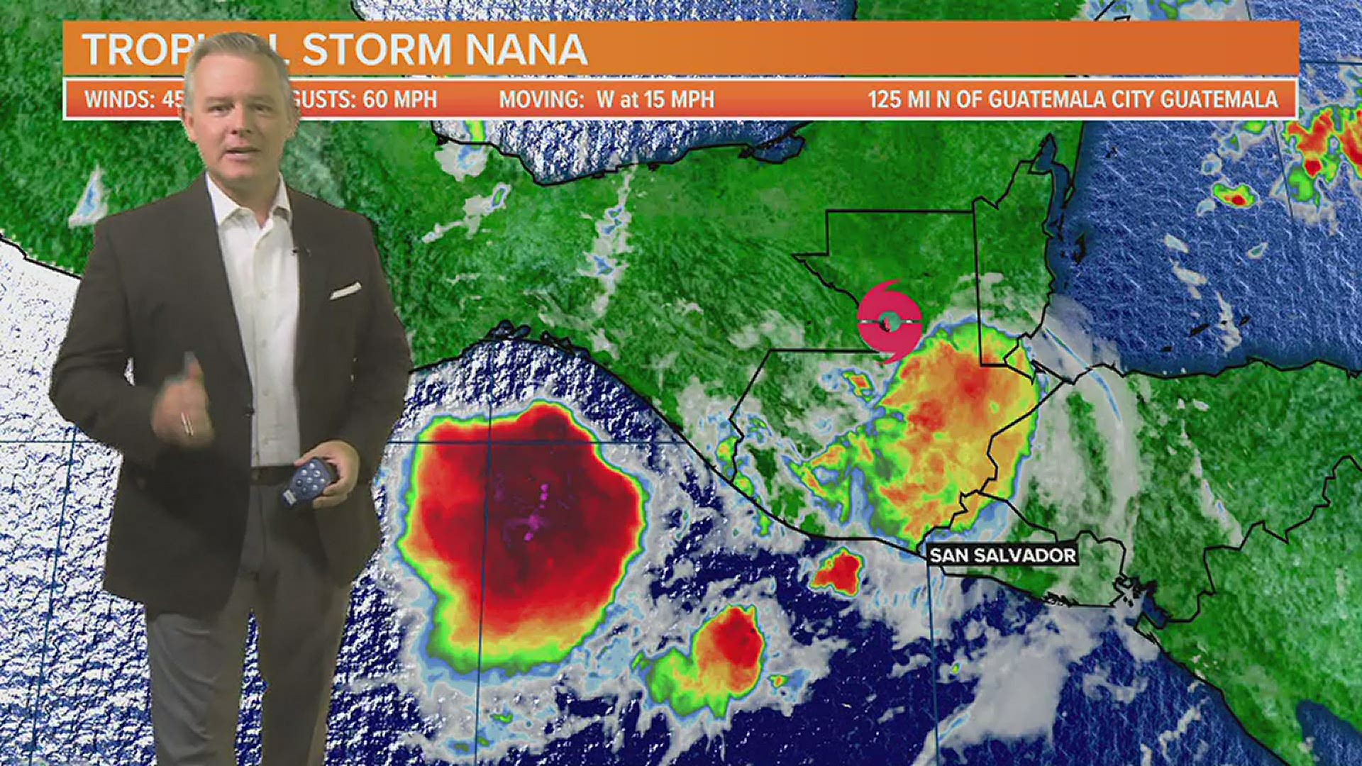
Hurricane Nana made landfall early Thursday morning in Belize as a Category 1 storm. It was the first hurricane to make landfall in Belize since Earl in 2016.

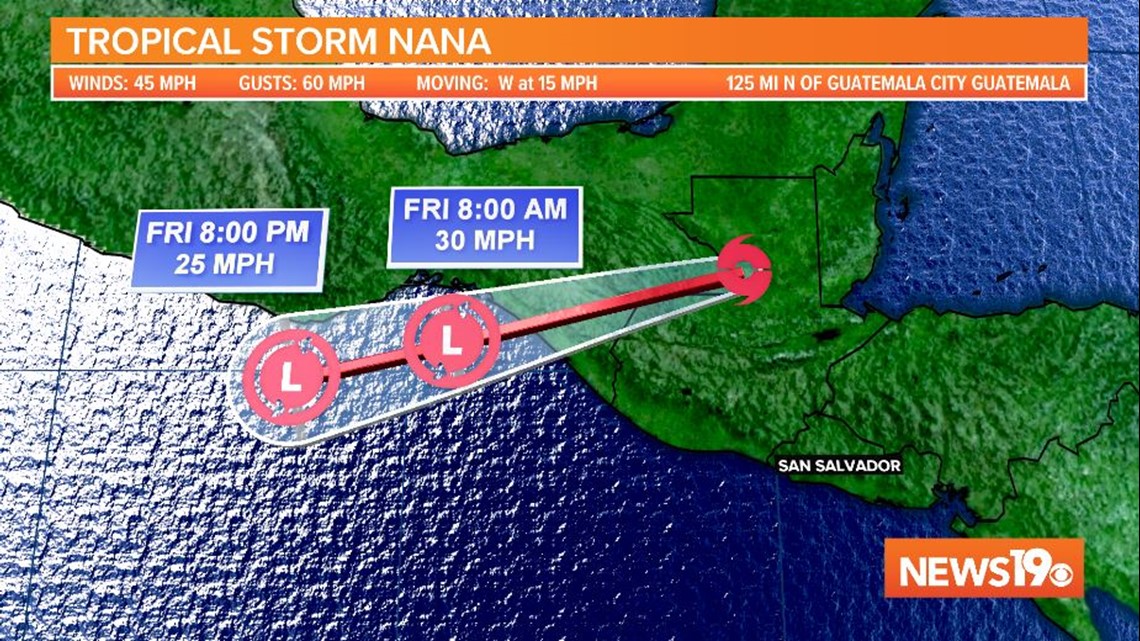
Nana will continue to weaken. It is expected to move into the eastern Pacific, but it is not forecast to regenerate.
Tropical Depression Omar is still out in the middle of the Atlantic. It is hanging on as a depression with winds of 35 mph.

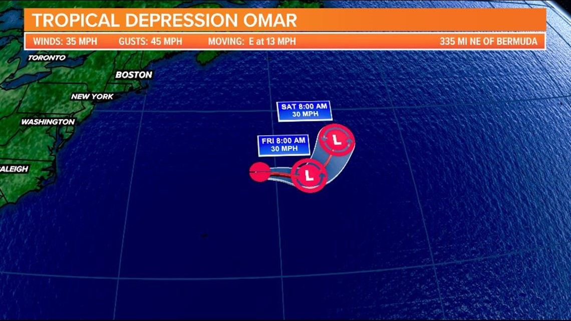
Omar will slowly dissipate over the few days as it churns well-north of Bermuda. There are no watches or warnings in association with this depression.
The next three Atlantic storm names are: Paulette, Rene and Sally. According to Dr. Philip Klotzbach of Colorado State University, the current record for the earliest 16th through 18th named storms are: Philippe on September 17, 2005, Rita on September 18, 2005 and Stan on October 2, 2005.