COLUMBIA, S.C. — Early Sunday morning, the National Hurricane Center confirmed from Hurricane Hunter data that Tropical Depression 10 had strengthened to a Tropical Storm. Idalia (ee-DAL-ya) is still expected to move into the open waters of the Eastern Gulf of Mexico before landfall in Florida early this week.
As of 11 p.m., the National Hurricane Center has Tropical Storm Idalia with winds of 60 mph off the Yucatan coast. It is expected to move into extremely warm waters in the upper 80s along with a low-shear environment. This should allow it to easily strengthen as it approaches Florida. Right now, the National Hurricane Center (NHC) expects Idalia to reach category 2 with winds of 110 mph, making landfall in the Big Bend region of Florida on Wednesday.


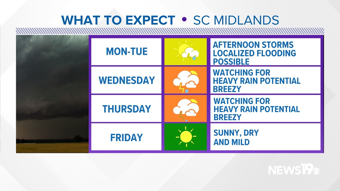
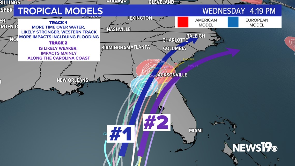
While impacts along the Florida coast will mainly be from wind and storm surge, the Carolinas and Georgia will mainly be looking at a heavy rain threat.
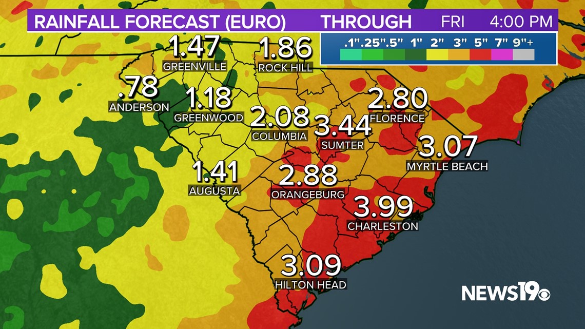
Over the next few days, a stalled front will provide the chance of daily thunderstorms in the afternoon and evening. This will lead to a localized flash flooding risk where storms drop heavier amounts of rain. This boundary will be an important part of how much rain we see when it comes to Idalia. The front will essentially act as an axis for the potential of heavy rainfall and help push Idalia to the East. Where this axis of rain sets up could see a high risk for flooding. The forecast looks to be around three to five inches of rain, with locally higher amounts where this occurs.


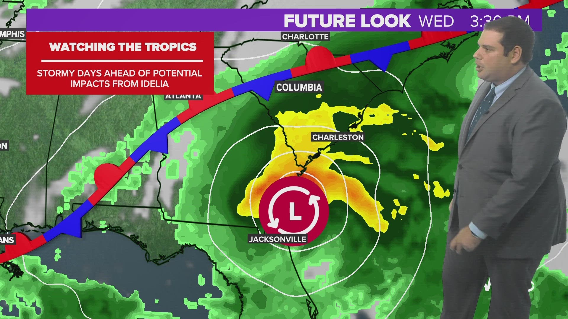
There are two lines of thinking with this storm for path still. An overall shift east has led to a more inland path and coastal path for the storm through Georgia and South Carolina. A more inland track would result in more rain and a much higher flooding threat. A coastal track would keep most impacts on our coast and reduce rainfall inland. This system still has some uncertainty, so things will change with the track.

Timing-wise, it looks like very late Tuesday into early Wednesday is when South Carolina will begin to see any impacts. We will watch for breezy conditions and heavy rain in the area on Wednesday and Thursday.
By Friday, we will see the system moving out. A northeast flow will keep things dry and cool for this time going into next weekend.