
COLUMBIA, S.C. — Tropical activity in the Atlantic is ramping up. There could be two more named storms in the tropics over the next few days.
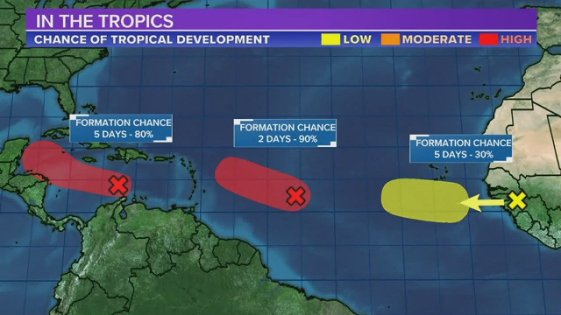
The National Hurricane Center is currently watching three areas in the tropics for possible development.
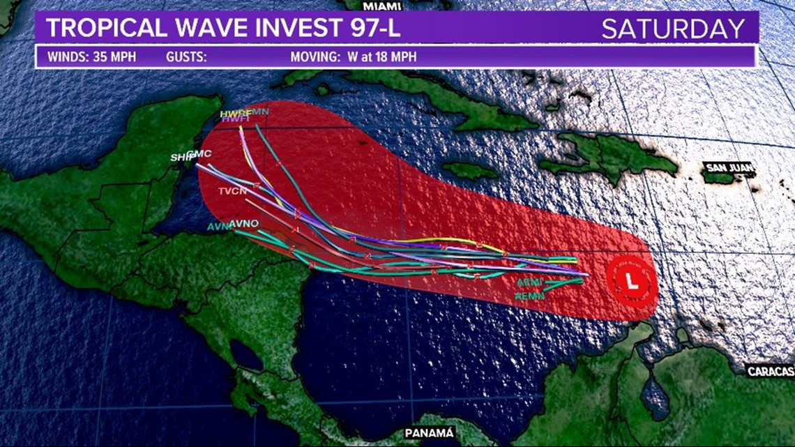
A tropical wave is moving over the central Caribbean. This is producing a concentrated area of shower and thunderstorm activity.
This tropical wave is moving west at about 15 to 20 mph. It is expected to continue to move generally west-northwest over the Caribbean Sea over the next few days.
Development is not likely until the system moves into the northwestern Caribbean where the upper-level winds will be more conducive for tropical development.
This disturbance may become a tropical depression later this week. The NHC gives this area a 80% of further development over the next five days.
The spaghetti models for what is being called Invest 97-L are below.

Another tropical wave over the eastern Atlantic is being monitored for possible development.
A broad area of low pressure is moving through the Atlantic, a tropical depression may develop.
This system will continue to move generally west-northwest at about 15 to 20 mph across the central and western Atlantic.
The NHC gives this area a 90% of further development over the next two today, a 90% chance of further development over the next five.
The spaghetti models for what is being called Invest 98-L are below.


The third area being watched by the NHC is coming off the African coast. It will move over the extreme eastern Atlantic on Friday.
There is a low chance of further development over the next two days. This disturbance is moving west-northwest at 15 to 20 mph.
These tropical waves will not impact the United States mainland over the next five days, but we will have to continue to watch these closely.
The Atlantic has had 11 named storms so far this season, but only two hurricanes.
It is the first hurricane season on record in which nine tropical storms formed before August 1.


Hurricane season officially goes from June 1 to November 30. It sharply peaks from late August through September.
The season's climatological peak of activity occurs around September 10 each year.