COLUMBIA, S.C. — We're tracking a chance for wintry weather Friday into Saturday which could bring freezing rain or snow to parts of the Midlands. This comes just days after an ice storm brought widespread impacts to the northwestern Midlands at the start of the week on Sunday.
What we know so far
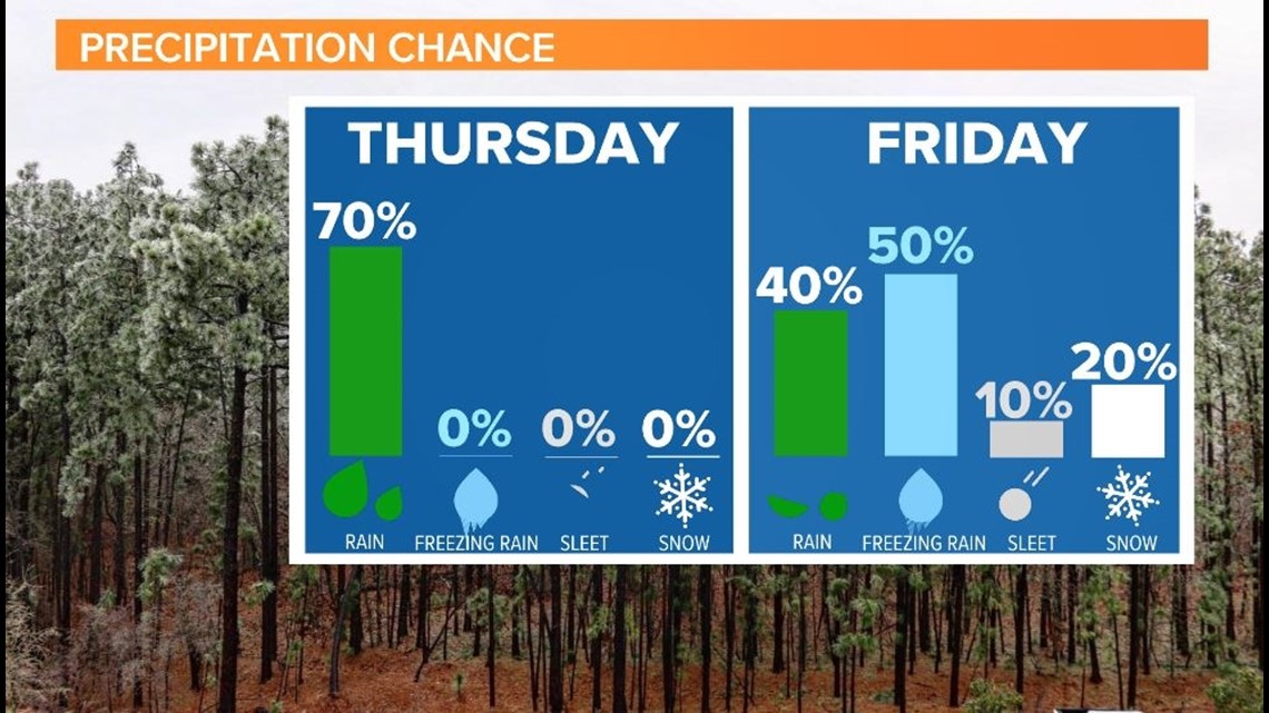
Warmer weather is expected Tuesday afternoon and Wednesday before a cold front arrives on Thursday and brings rain. The front will stall over South Carolina on Thursday bringing persistent, although mainly light, showers and keeping temperatures consistently in the 50s for most of the day. The winter weather risk all rides on what happens to that front as it pushes eastward on Friday.
Our thoughts as of Tuesday morning is a guarantee that Thursday will be just rain, with no winter precipitation risk. We are expecting Friday to feature some icing from freezing rain. There is a chance for some snowflakes on the backend of the system late Friday into Saturday. The air will be cold enough, but dry air could mix in and cut off the chance for snow.
Limited impacts are expected on Friday or Saturday as of the latest model guidance, but there is the potential for bigger impacts with just a slight shift in the forecast track for this developing system. For now, we're leaving the chance for freezing rain at 50% for Friday, with just a 20% chance for any snow mixing in late in the day. There is still uncertainty about whether any winter precipitation will accumulate.

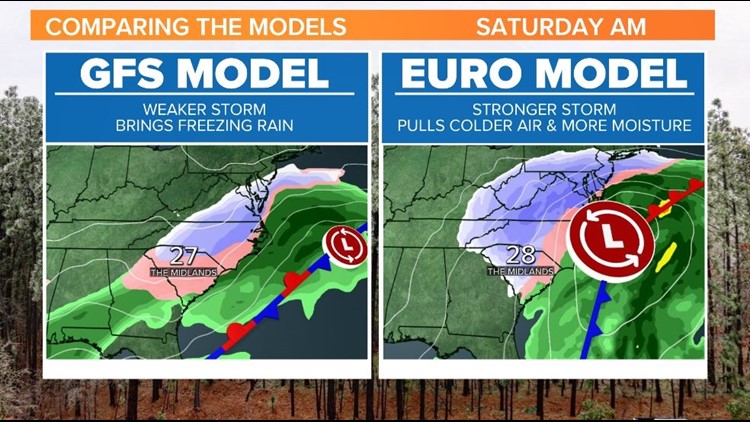
GFS Model Guidance
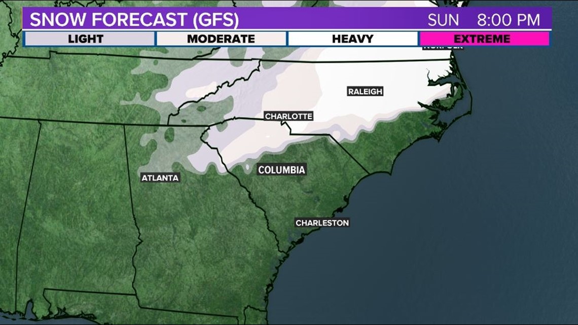
The Tuesday morning model GFS Model suggests a period of freezing rain in the Midlands on Friday with limited impacts. The model projection brings snow to parts of the Upstate and toward the Charlotte Metro, but cuts the moisture off before temperatures are cold enough to arrive here.
In this scenario, the stationary front develops small pulses of low pressure off the coastline. Instead of developing into a full fledge coastal storm, this system keeps showers around with warm air overriding the warm front and cold air pushing in at the surface. This pattern would keep snow entirely out of the forecast and bring in enough dry air to limit any major impacts from freezing rain.


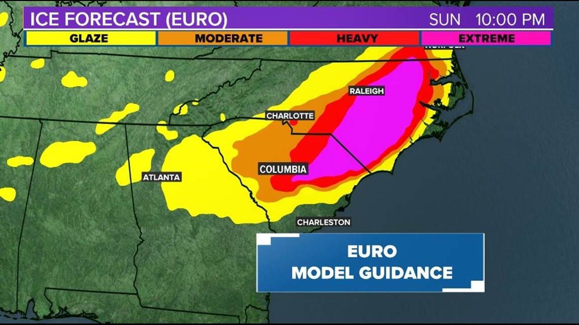
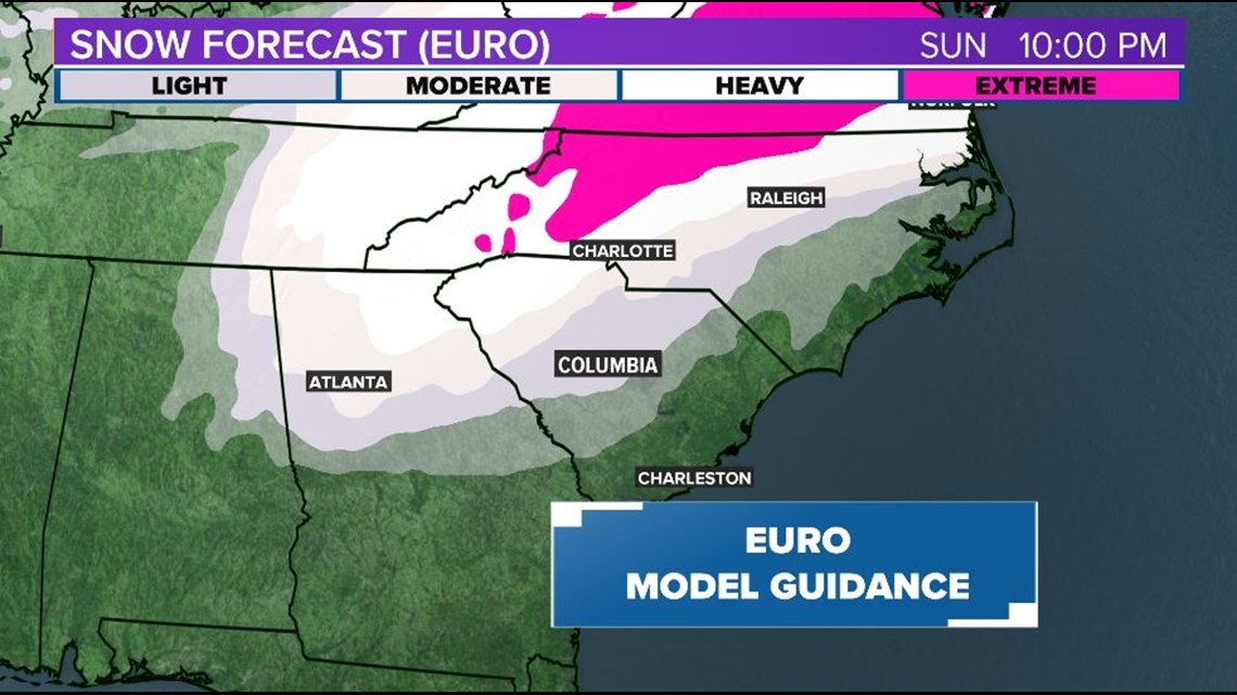
European Model Guidance
The latest model run of the EURO model from Monday night continues the trend of previous runs. A strong coastal low develops which brings cold air and moisture into the Midlands. This scenario brings an ice storm to the eastern Midlands and accumulating snow to the western Midlands.
At the moment, our forecast is favoring the GFS Model guidance which makes this storm system a low impact situation for us Friday and Saturday, but there is the potential for bigger travel disruptions. We will know much more when the short range model data comes in overnight on Tuesday. By Wednesday we'll see how some of the smaller scale features will come into play for this end of the week storm system.


Regardless of the wintry precipitation chance, a winter feel is expected Friday into early next week. High temperatures on Friday will be near 40F at midnight with temperatures dropping into the low 30s by the afternoon. Saturday morning will be in the 20s with a chance for some snowflakes. Despite some afternoon sunshine, highs on Saturday will struggle to reach 40F.