

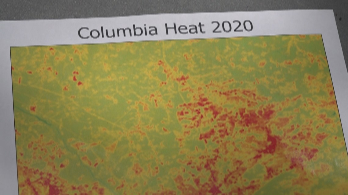
COLUMBIA, S.C. — Heat is the number one weather-related killer in the country. In recent years, there has been a push to understand the heat -- especially in our cities. This summer, scientists are looking for volunteers to help map out Columbia's urban heat island.
The urban heat island is something we encounter everyday in the city. Unlike how we normally think about heat in a given area, the urban heat island is something that drastically changes in a matter of feet, depending on surrounding materials. That’s where the mapping steps in. Mapping gives scientists the opportunity to look at temperatures in resolutions that would otherwise be impossible.
“We are one of fourteen communities that’s been selected in the United States plus, two communities internationally to be part of a heat mapping project," says Kirstin Dow, a professor at USC involved with the mapping project funded by the National Integrated Heat Health Information System.

Mapping, says Dow, "brings together citizen scientists. They will put a sensor on the window of your car -- like a Gamecock flag -- and they will drive around routes in the city and identify the microclimates and the very localized heat.”
Scott Curtis, the director of the Near Center for Climate Studies, helped the city of Charleston map their heat island just last year. He says the data they received gave them a new perspective of that city’s heat.

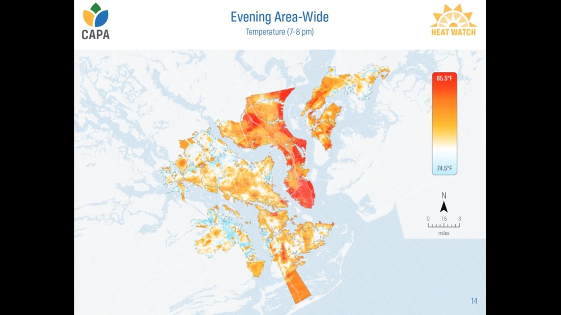
“One of the interesting things is we didn’t see a whole lot of influence from the sea breeze or being close to the ocean… I think a bigger effect that will be found in Columbia as well is just the presence of trees. One of the areas (in Charleston) that was the hottest was the port -- and not because it was near the water, obviously. Because there is lots of asphalt, lots of concrete, there’s just no vegetation at all there.”
Getting data like this, the hope is that city planners and local governments will be able to combat heat-related issues and plan ahead especially in our ever-warming climate.
If you are interested in volunteering by driving around the city to collect temperature data this summer, you can sign up using this link: https://bit.ly/ColaHeatMap