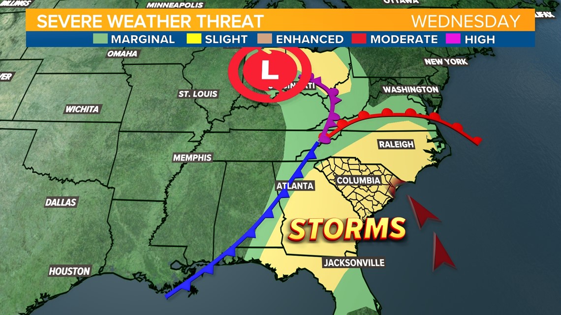
COLUMBIA, S.C. — Rain is expected on Wednesday in South Carolina, with a risk for a few embedded strong thunderstorms during the afternoon and evening. The Storm Prediction Center has issued a “slight” risk for severe thunderstorms with the primary risk being damaging wind. There is also a chance for an isolated tornado, although the risk is much lower for South Carolina than when the storm system swept through the Deep South on Tuesday.
A slight risk for severe weather from the Storm Prediction Center means there is a 15% chance for damaging wind within 25 miles of your neighborhood. This is a level 2 out of the 5 risk levels the Storm Prediction Center issues and it means that any severe weather will be scattered.

In addition to gusty thunderstorms, strong winds from the south will bring breezy conditions through the afternoon. The National Weather Service in Columbia has placed the Midlands under a Lake Wind Advisory for Wednesday afternoon. Strong winds will produce rough waves that will be hazardous to small craft on our lakes.
The Timing
Light rain will persist through the mid-morning with rain becoming widespread around noon time. A few embedded thunderstorms are possible and could produce gusty winds.


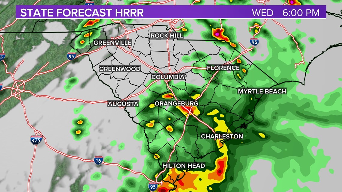
Model guidance indicates strong storms could develop along and east of the I-26 corridor and toward I-95 during the late afternoon and early evening. A few of these storms may bring localized flooding, frequent lightning, and damaging wind.

Rainfall on Wednesday will likely remain under 1” for most of the Midlands except in isolated thunderstorms.
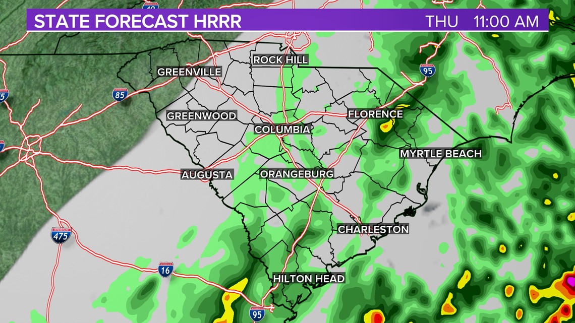
The cold front responsible for these storms will stall along the South Carolina coast on Thursday which keeps the chance for showers in the eastern half of the state through much of Thursday morning. Some clearing is expected in the western Midlands on Thursday. Temperatures will be much cooler – in the 60s
Sunshine returns for the entire state on Friday and the weekend will remain clear and cool.