
COLUMBIA, S.C. — Cold weather is a natural part of winter, and the northern plains are typically the source for the worst of it. The "freezer of the country" is expected to open up this weekend which can drop temperatures below 0F as far south as Texas by early next week. Current model trends keep the arctic cold out of South Carolina and instead delivers unsettled weather for us in the form of showers and chilly temperatures.
How cold will it get?
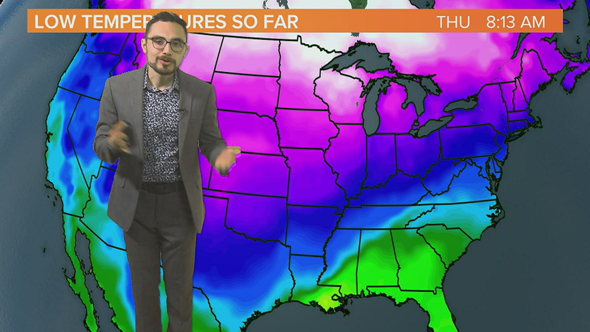
Temperatures in the northern plains have been cold all week. On Wednesday, Rudyard, MT was the coldest city in the country at -40F. It was even colder for Cotton, MT on Monday where temperatures dropped to -43F. On Thursday morning, International Falls, MN dropped to a frigid -36F. Skin damage begins in less than 10 minutes at these temperatures.
Forecast confidence has been lower than usual the past few days, but confidence is increasing that the eastern US will miss out on the worst of the Arctic cold, which is now aiming for the central plains. Models indicate that temperatures could drop more than 30 degrees below normal for the central plains starting on Valentines Day. By Tuesday morning, current trends bring temperatures into the teens all the way down to Houston and near 0F for Dallas.
The Thursday morning GFS model run had a morning low of -13F for Oklahoma City which is more than 40F below average. If this verifies, it will be the coldest morning in a lifetime for the city and the second coldest on record. Farther south, cities like Dallas could drop to 0 degrees for only the 4th time in history. Austin, Texas could drop into the single digits. The average winter in Austin is similar to Columbia, SC.


Here in the Midlands
A frontal boundary will stall over the east coast on Friday. This will bring rounds of cold rain to the South Carolina Midlands through early next week. A thick cloud cover and frequent showers will keep afternoon temperatures about 10 degrees cooler than average for our area. While we will struggle to get out of the 40s, that's not arctic cold. Low temperatures will stay in the 40s and upper 30s through next week. There are no hard freezes in the forecast through early next week, but there is still time for a hard freeze.
Serious winter cold can occur in the South Carolina Midlands into the first week of March. Historically, temperatures in the single digits are rare in Columbia, SC but have been reported as late as March 3rd. After that date, severe cold is not likely, but it's not unusual for freezing temperatures to occur into the first week of April. The average last freeze for Columbia, SC is in late March.