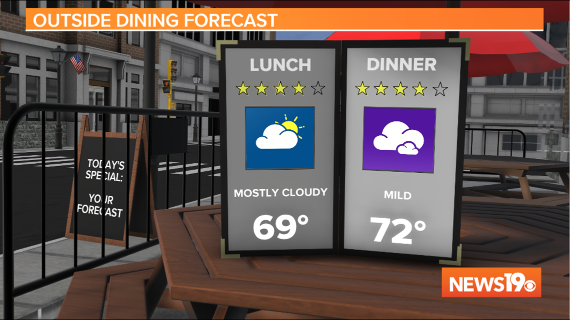
COLUMBIA, S.C. — Another cloudy day is in store for South Carolina to finish the weekend but thankfully our temperatures will remain mild. Most of the region started off in the 50s with a few light showers in the far northern Midlands. As we go into the afternoon temperatures will be in the mid to upper 60s for lunchtime and in the low 70s by dinnertime.
While there could be a few light showers in the northern Midlands and skies will be mostly cloudy, most locations are dry today.

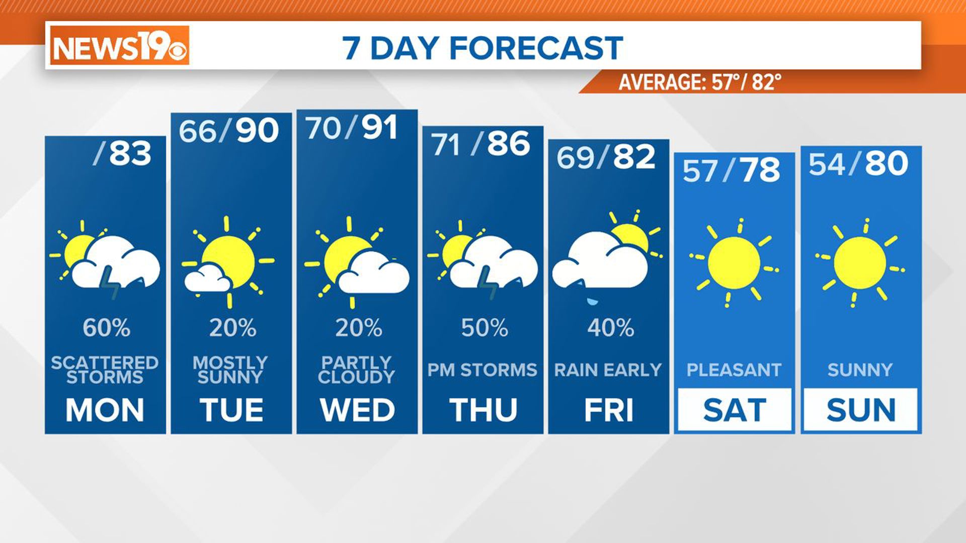
Monday will start off mild once again with lows in the low to mid 50s in the Midlands. However, the afternoon will be about 10 degrees cooler as high pressure wedges into the area. High temperatures will be in the low 60s under mostly cloudy skies.
Rain will move into the area late Monday into early Tuesday. Scattered showers are likely through the day Tuesday with cool temperatures once again.
More scattered showers are possible Wednesday.

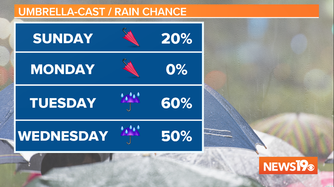
Temperatures are warmer on Wednesday and Thursday with highs back in the low 70s ahead of a cold front.
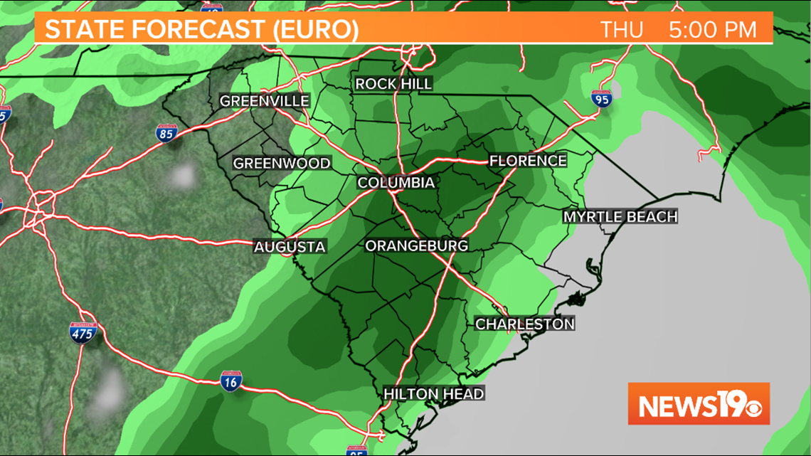
This cold front will move through South Carolina on Thursday bringing more showers and some thunderstorms. The Storm Prediction Center places most of South Carolina under a 15% chance of severe weather on Thursday with the passage of the front. We'll have a better idea of storm potential, timing, and any risks over the next few days.

Behind the front, drier and cooler conditions are expected for Friday and Saturday. Highs on both days are forecast in the low to mid 60s.