COLUMBIA, S.C. — Temperatures were much cooler today across the Midlands were much cooler than this weekend. Our high of 68 was about 10 degrees cooler than Sunday. We still saw plenty of sunshine and the good news is that things look to be on the same track for our Tuesday.
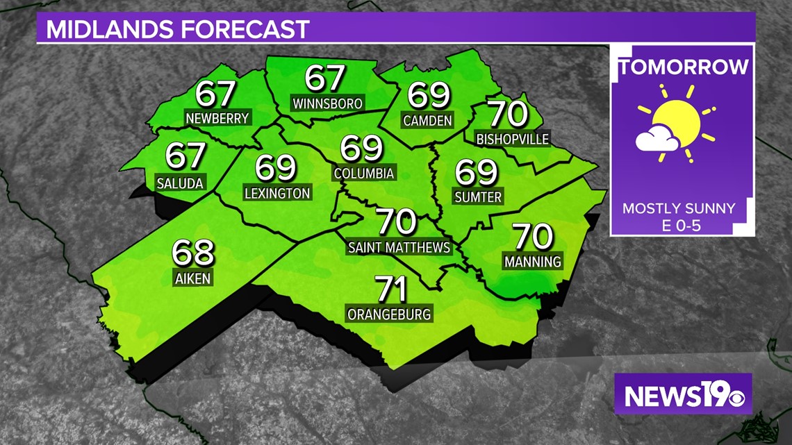
Overnight lows will be cooler with calmer winds and clear skies expect lows to reach the lower to middle 40s by tomorrow morning. Sunshine will allow for us to warm up nicely with highs approaching right around 70 in the afternoon hours. We will start to see some clouds moving in during the evening.

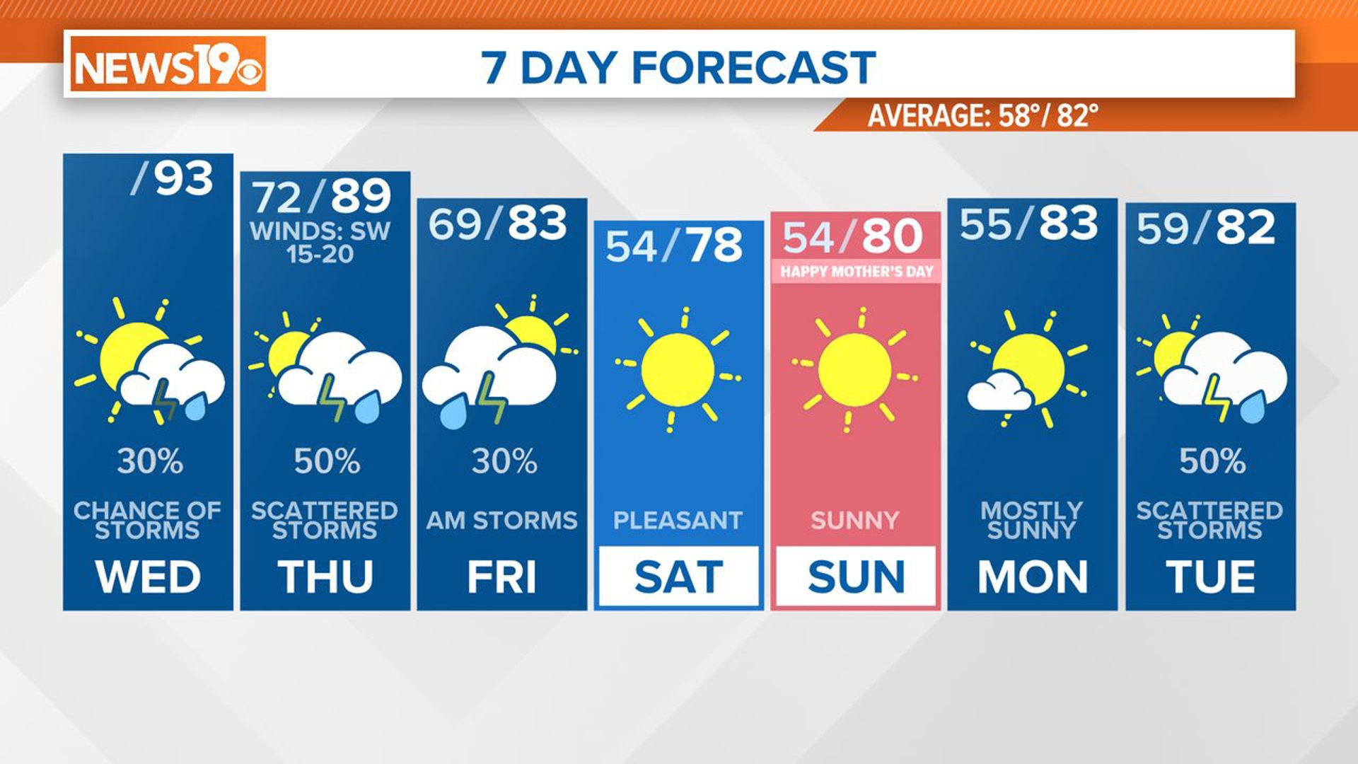
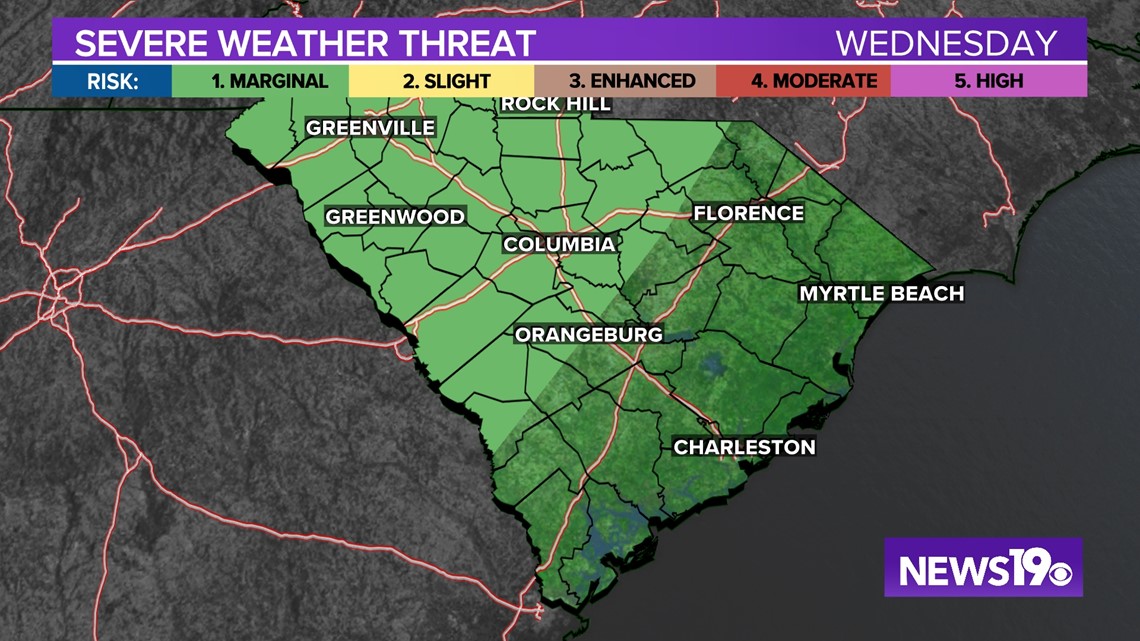
Going into Wednesday, we are tracking the chance of some heavy rain to move through the region. Severe weather looks like it could be widespread in places like Louisiana, Mississippi, and Tenneessee on Tuesday. As for us we are tracking mainly just some heavy rain. The Storm Prediction Center does have a marginal risk of severe weather for the western half of the Midlands, but the thinking is any strong winds will be pretty isolated.

As for timing and what to expect, rain will start to move in around 2-4 am moving from the west to east. The main line associated with the cold front looks to move in around 7-10am. This is where we could see some isolated gusty winds along with heavy rain just in time for the morning commute. The good news is that this rain moves out pretty quickly and we could see some sunshine by the end of the day.