COLUMBIA, S.C. — This week is winter weather awareness week and with it feeling like winter the next few days it is the perfect time to explain some of the types of precipitation we can expect over the coming months.
During the warmer months, we expect rain to fall from the sky but as temperatures fall, we can see all sorts of precipitation here in the Midlands.
When it comes to winter weather things aren't cut and dry, very small changes in our atmosphere can lead to very different outcomes and it all comes down to the temperatures we see.
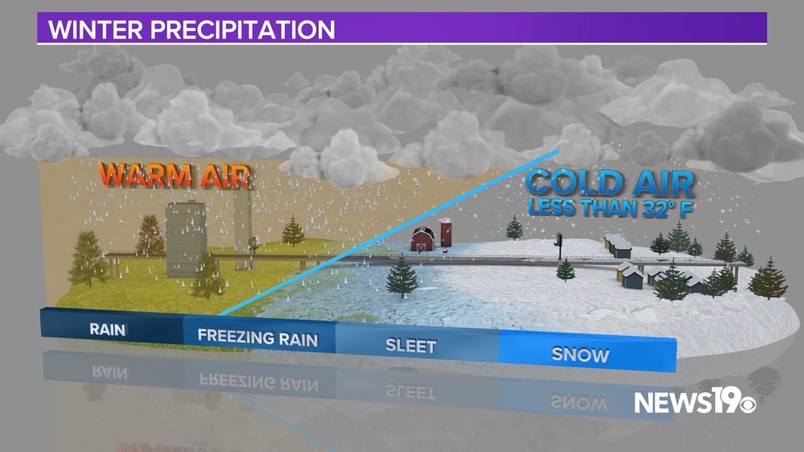
If temperatures from the cloud to the ground are at or below freezing, this is when we can expect snow to fall in the region.


While this can occur this is not what we typically see.
Our winter setups typically include some warmer air, and the amount can have big changes in impact.
If a very small layer of above freezing temperatures forms, the snow will melt and then re-freeze into sleet or ice pellets.
If that same warm layer is deeper it will result in the melted snow hitting the surface as rain. Because the surface is at freezing, this rain freezes on contact what we call freezing rain.
This precipitation has the biggest impact on us here in the Midlands as it can bring down trees, and knock out power due to the weight it adds to power lines.
In the case of all three, travel conditions can be greatly impacted.


