COLUMBIA, S.C. — We are keeping an eye on two weather systems in the Atlantic. The first one near the Windward Islands might bring heavy rains and strong winds to the Lesser Antilles, but it is not expected to become a significant storm. The second system, located south-southwest of Bermuda, has a slight chance of gradual development as it moves toward the southeastern U.S. coast.
In the southwestern Atlantic, a weak area of low pressure is located a few hundred miles south-southwest of Bermuda. Right now, this system is not very organized and does not have much strength. It is moving west-northwestward, heading towards the southeastern coast of the United States later this week and into the weekend.

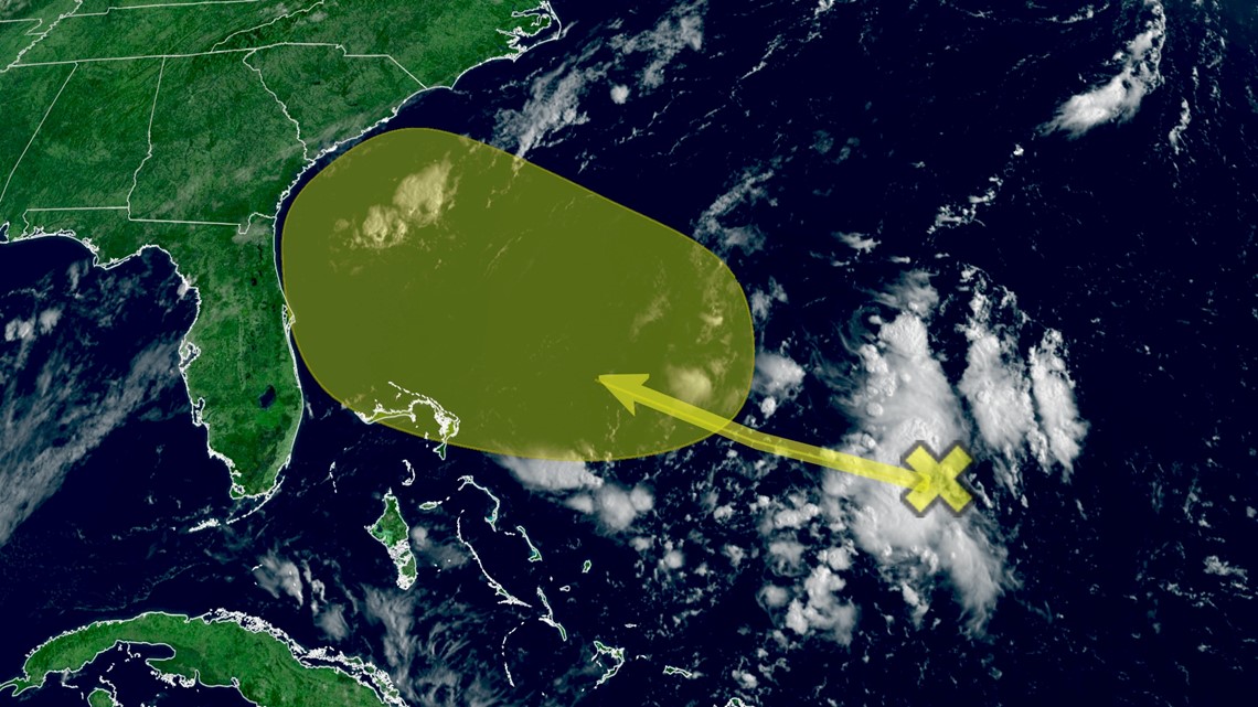
The National Hurricane Center gives this a low chance of further development over the next seven days. As of Tuesday morning, the global models do not show this low developing into anything, but it will be worth watching.
Another tropical wave near the Windward Islands is causing disorganized showers and thunderstorms. This weather system is moving quickly westward. However, it is not very organized, so any development into a storm might be slow during the next day or two. Additionally, it is expected to encounter unfavorable upper-level winds soon.

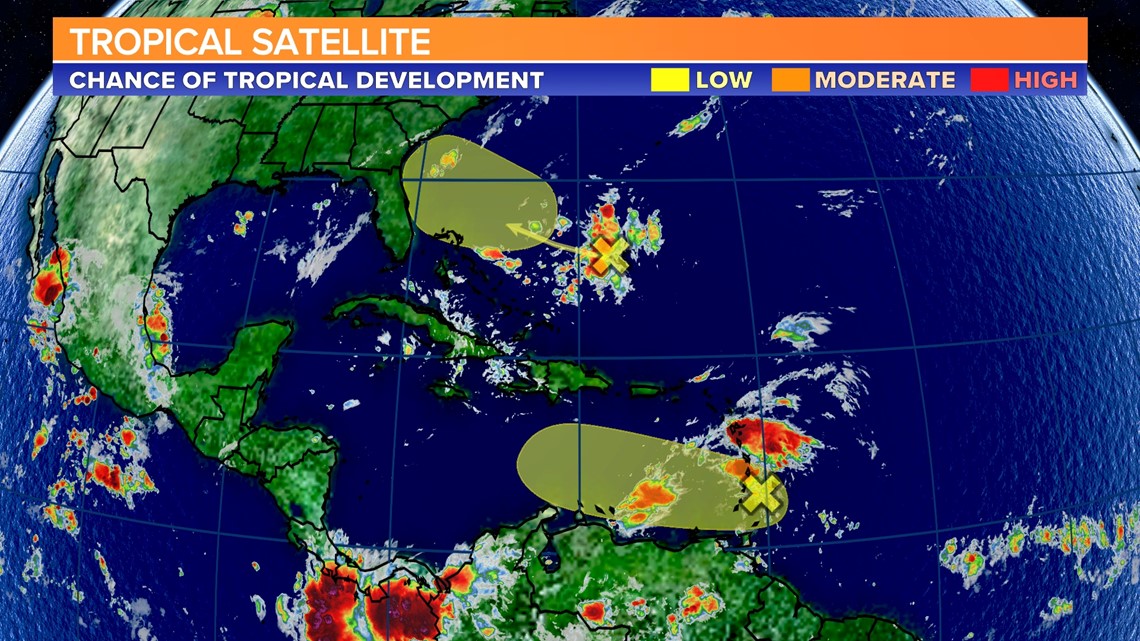
Regardless of whether it becomes a storm, the area around the Lesser Antilles should brace for locally heavy rains and strong gusty winds in the next day or so.
The National Hurricane Center gives this a low chance of further development over the next two days.