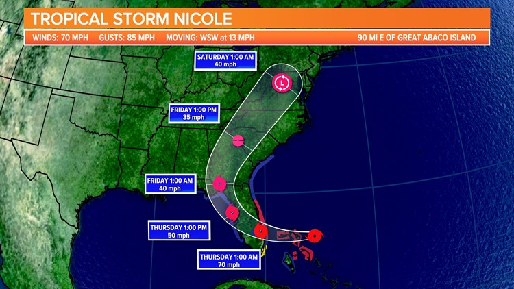
COLUMBIA, S.C. — Tropical Storm Nicole is expected to affect South Carolina's weather this week, bringing a chance of rain and even some severe weather by Thursday into Friday.
Dry, breezy, and cooler weather is expected today as a strong area of high pressure builds in from the north. Moisture begins to increase Thursday as Tropical Storm Nicole continues to move closer to the state. Moderate to heavy rain with some gusty winds is expected starting Thursday afternoon, lasting into Friday. Much cooler and drier weather will fill in behind this system for the weekend.
Today will be quiet and cooler. Temperatures will be in the middle to upper 60s later today under partly to mostly cloudy skies. Breezy conditions will continue through the day due to the pressure gradient between the strong high to the north and Nicole to our south. Northeasterly winds 10 to 20 mph with gusts around 25 mph are possible through the day.

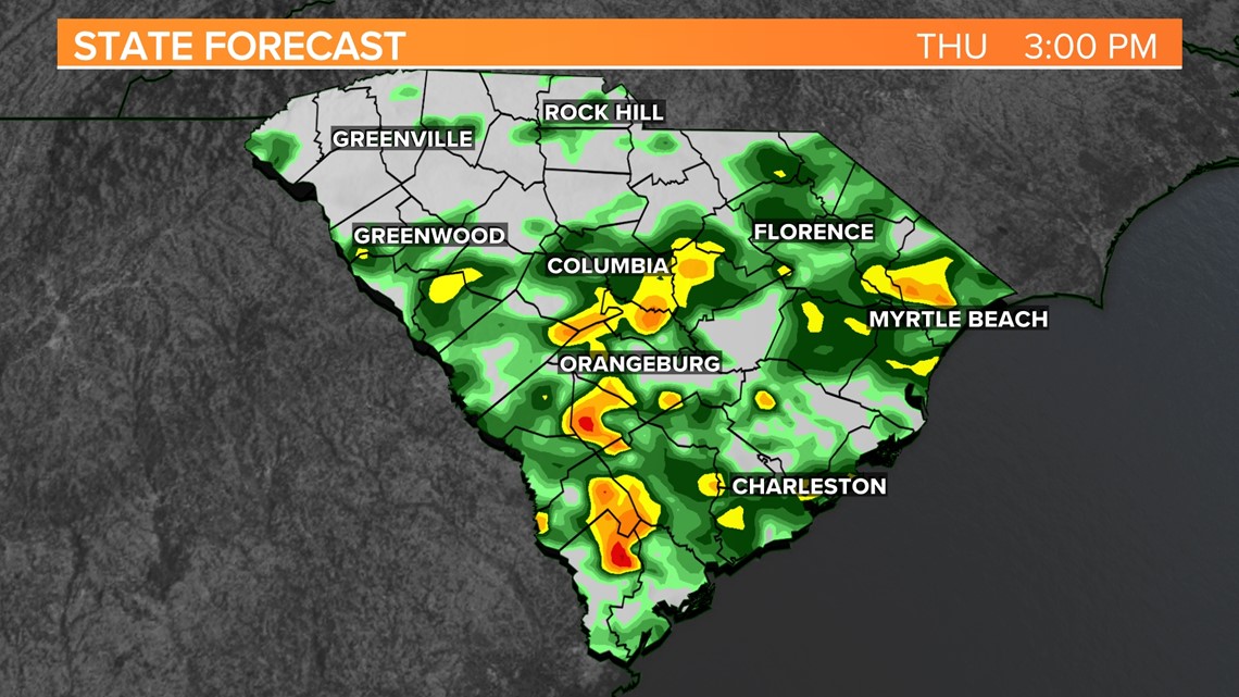
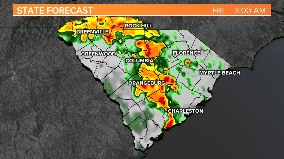
Tropical Storm Nicole is forecast to bring rain to the area starting Thursday afternoon. The showers and storms will last through at least late Friday afternoon. Gusty winds, moderate to heavy rainfall, and isolated tornadoes are possible.

Rain will begin to spread across the Midlands Thursday afternoon. Waves of heavy to moderate rain will impact the area. This will continue off and on through Thursday evening. Overall, total rainfall amounts are expected to range from 1 to 3” for the Midlands.

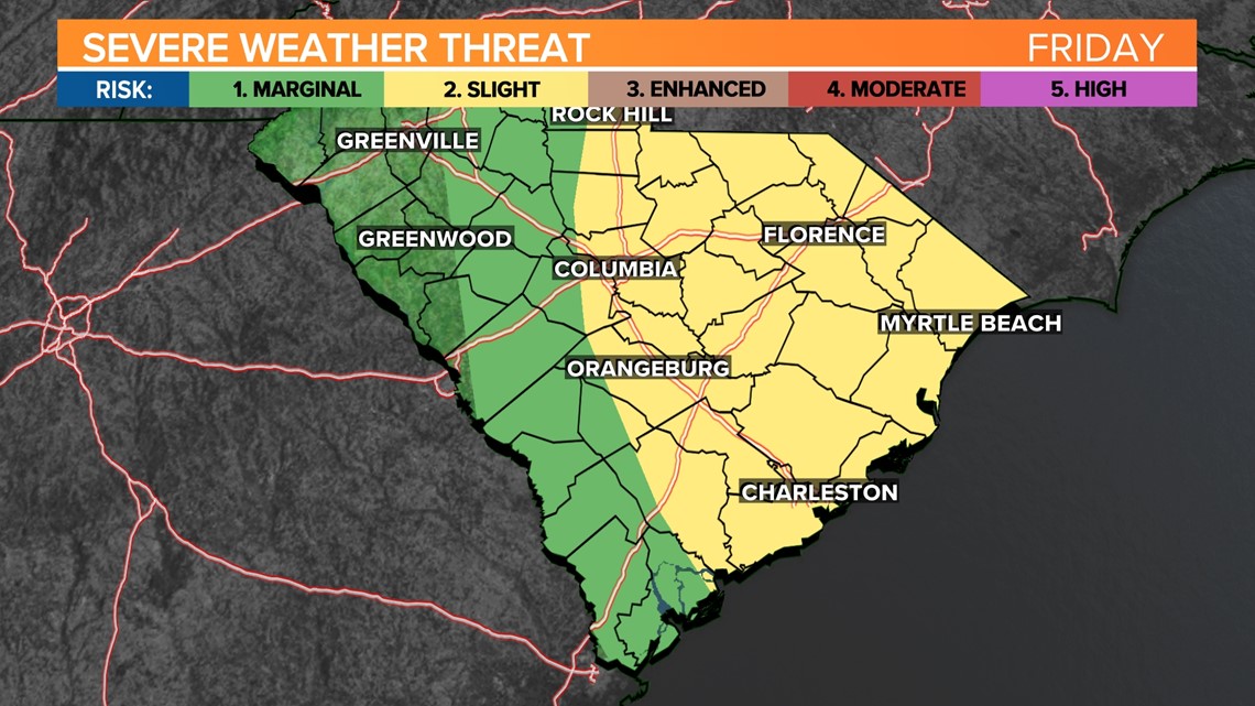
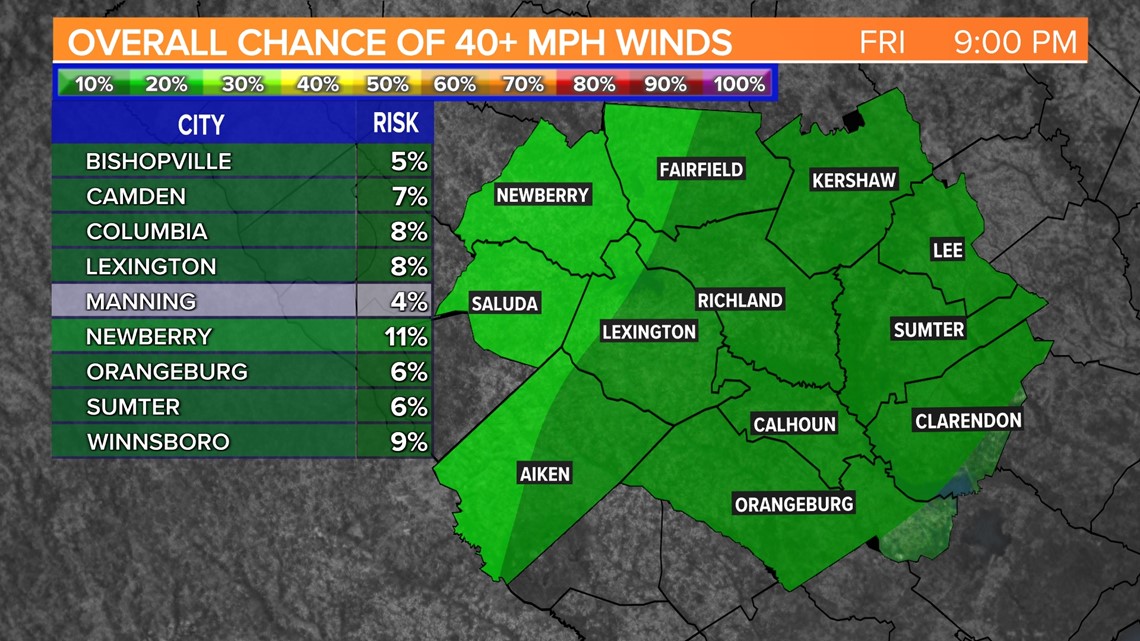
The tornado risk will increase Thursday evening through Friday morning. Isolated tornadoes will possible across South Carolina, but the highest risk will be in the eastern part of the state. The Storm Prediction Center has the eastern half of South Carolina under a slight risk for severe weather Friday.
The majority of tornadoes associated with tropical systems occur in the right front quadrant of the storm. This area typically has the best wind shear and instability. We will be in this area given the current track of Nicole.
Most of the tropical tornadoes that impact the Midlands are from tropical systems that make landfall in the Gulf of Mexico and continue on a path toward the north and northeast. Usually, tornadoes produced by tropical cyclones are relatively weak and short-lived, but they still can pose a significant threat.

Nicole will quickly exit the state late Friday. Drier, cooler air will move in for the weekend. Skies will be mostly sunny Saturday with highs in the lower 70s, but Sunday temperatures may only top out in the upper 50s.