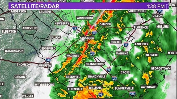
COLUMBIA, S.C. — Heavy wind and rain moved through several parts of the South Carolina Midlands on Thursday, bringing at least one report of a possible funnel cloud in the Lake Wateree area that is now being investigated by the National Weather Service.
However, most of the storms and a corresponding tornado watch for multiple Columbia-area counties have expired or otherwise moved out of the region. Expect clear weather in the Midlands from here on out and more of it for the weekend.
4:46 PM: With all watches and warnings cleared for the Midlands, clear weather is returning to the area and is expected to stay clear through the weekend.
4:41 PM: The National Weather Service has canceled the Tornado Watch for Clarendon and Orangeburg counties.
3:47 PM: The National Weather Service has canceled the Tornado Watch for Calhoun, Kershaw, Lee, and Sumter counties but said it continues for Clarendon and Orangeburg counties until 8 p.m.
2:04 PM: The National Weather Service has canceled the Severe Thunderstorm Warning for Kershaw County.
1:43 PM: The National Weather Service has continued the Severe Thunderstorm Warning for Kershaw County until 2:15 p.m.
1:31 PM: A Strong thunderstorm is expected to impact portions of northwestern Calhoun and southeastern Richland counties until 2 p.m. The storm may include 40 mph winds and hail.
1:25 PM: A Severe Thunderstorm Warning has been issued for Kershaw County until 2:15 p.m. The storm may be capable of producing a tornado, 60 mph wind and hailstones up to three-quarters of an inch.
1:18 PM: Strong thunderstorms are expected to impact portions of north-central Kershaw County through 1:45 p.m. The storms could have wind gusts up to 50 mph, knocking down tree limbs and blowing insecure objects.
1:05 PM: Strong thunderstorms are expected to impact portions of northern Richland and central Kershaw counties through 1:30 p.m. The storms could have wind gusts up to 50 mph knocking down tree limbs and blowing insecure objects.
1:00 PM: The National Weather Service has canceled the Severe Thunderstorm Warning for Richland County but said it will continue until 1:15 p.m. for Fairfield and Kershaw counties.
12:50 PM: A trained spotter in Fairfield County has reported seeing thunderstorm wind gusts of 55mph and a funnel north of Ridgeway.
12:50 PM: The National Weather Service has issued a Tornado Watch for Calhoun, Clarendon, Kershaw, Lee, Orangeburg, and Sumter counties until 8 p.m.
12:50 PM: A Severe Thunderstorm Warning with possible tornadoes has been issued for Fairfield, Kershaw, and Richland counties.
12:43 PM: WLTX Weather Watcher Sherry Sanders Alexander shared this photo of a potential funnel cloud near Lake Wateree.
11:57 AM: Meteorologist Daniel Bonds reports that severe weather is possible for a large swath of South Carolina including much of the Midlands. Strong to severe storms will be possible mainly between 2 p.m. and 4 p.m.