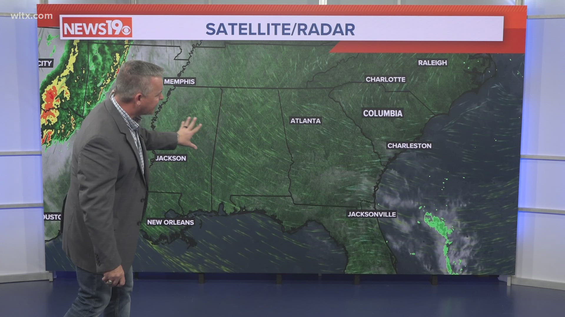
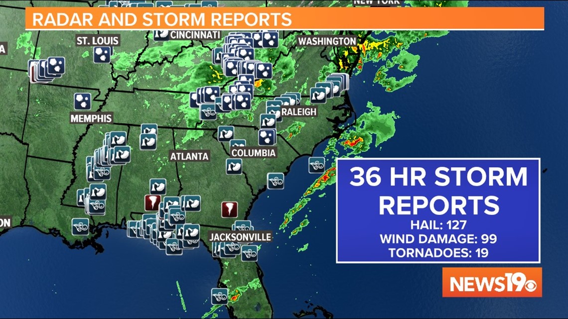
COLUMBIA, S.C. — The forecast for severe weather in the South Carolina Midlands did not pan out on Thursday. Some parts of the Midlands didn't even see rain, but not everyone in the southeast was as lucky as South Carolina. As of early Friday morning, 14 tornadoes were confirmed across the south from Wednesday afternoon through Thursday with 99 wind reports. Some of those wind reports will likely be confirmed tornadoes after the local National Weather Services view the damage. Our forecast for the Midlands was based on science so we can explain why it didn't pan out and severe weather missed South Carolina.
The Forecast
A developing area of low pressure over Texas and Oklahoma on Wednesday brought significant tropical moisture into the southeast increasing the risk for severe weather ahead and along an approaching cold and warm front. The spin in the atmosphere from the upper level jet stream, combined with and warm, humid air at the surface, is ideal for tornado development. That's why on Wednesday, the Storm Prediction Center highlighted Mississippi in the "high risk category". High risk is a level 5 out of 5 on their severe weather scale and an indication of widespread severe weather. An organized line of storms was expected to shift eastward so the Storm Prediction Center placed South and North Carolina, including all of the Midlands, in a level 4 out of 5 "Moderate" risk for Thursday's severe weather.
Numerous tornadoes were reported in the deep south on Wednesday, but the number was less numerous than indicated during the high risk forecast. Although tornadoes and wind created damage in these states, it was fortunately not a historic outbreak. This prompted the Storm Prediction Center to downgrade Thursday's severe weather risk in the Midlands from a level 4 "moderate" to a level 3 "enhanced". A Moderate risk indicates widespread severe weather, whereas Enhanced risk" indicates fewer, but still numerous severe thunderstorms. This was the forecast for Thursday morning, but something was happening to our south that would change the forecast for the better.

Why the Forecast was Wrong
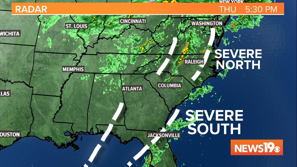
A line of severe weather pushed through the Gulf Coast early Thursday morning much faster than anticipated. Winds as high of 74 mph were reported in Panama City, Florida and at least 2 morning tornadoes touched down in southern Alabama from this quick moving line of severe weather. The strength and speed of these storms broke the line up over north Georgia leaving a gap. With less energy to work with, storms didn't redevelop along that broken line in South Carolina. Instead the northern edge of that line fired up bringing numerous tornado warnings in North Carolina and Virginia and wind damage that will have to be investigated to confirm if a tornado was the cause.

Forecasts are only as good as the data we have and we don't have a perfect picture of the entire atmosphere. Our forecast is based on what we believe conditions are like at the time, and in this case we expected a solid line of storms and instead saw a broken line with severe weather north and south of our area, but sparing the Midlands. Historically, March and April are the most active months of the year for tornadoes so it's important to stay aware of the weather over the next few weeks and take each severe weather forecast seriously, even if the atmosphere sometimes gives us a beautiful day instead.