COLUMBIA, S.C. — This weekend kicks off the unofficial start of Summer but, it will be feeling more like January as we start off the weekend with plenty of cold and wet weather.
Starting off with Friday night, any outdoor plans should be unaffected as we see cooler conditions with overcast skies. No rain is expected in most of the Midlands until very late at night.
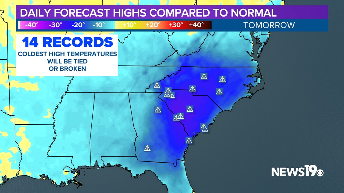
Let's break down the larger pattern. A cutoff low pressure system has formed off our coast and will very slowly move onshore as we go into Saturday. This low will stay in the general area through the beginning of next week keeping us cool and unsettled.

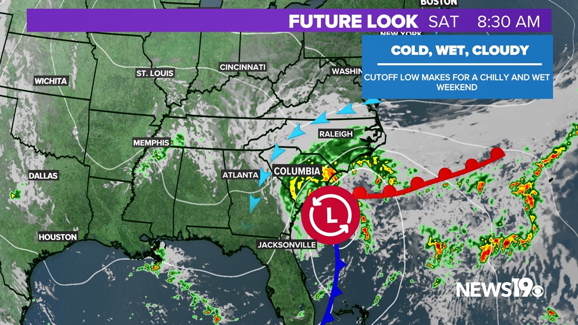
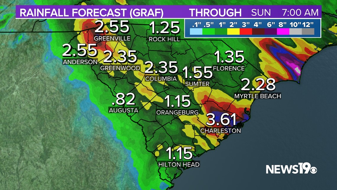
Saturday looks to be the worst day of the weekend by far. Rain will start early in the morning and last all day as the low crawls across the state. As of right now 1-3" of rain looks likely tomorrow with some locally higher amounts possible.

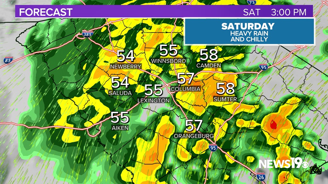

Temperatures will be down-right cold for this time of the year. Our high of 60° will likely occur at midnight with daytime temperatures in the middle to upper 50s. This should help smash the record for coldest May 27th on record in the Midlands.

On top of all of this, winds will be gusty with gusts of 20-30 mph possible during the day.

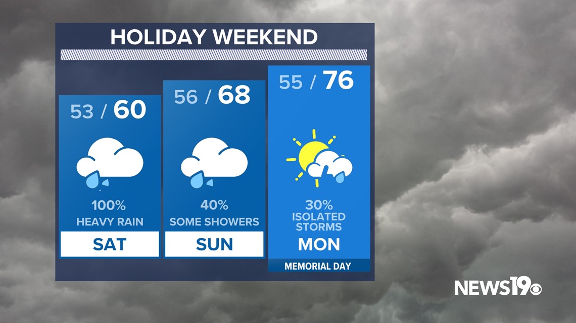
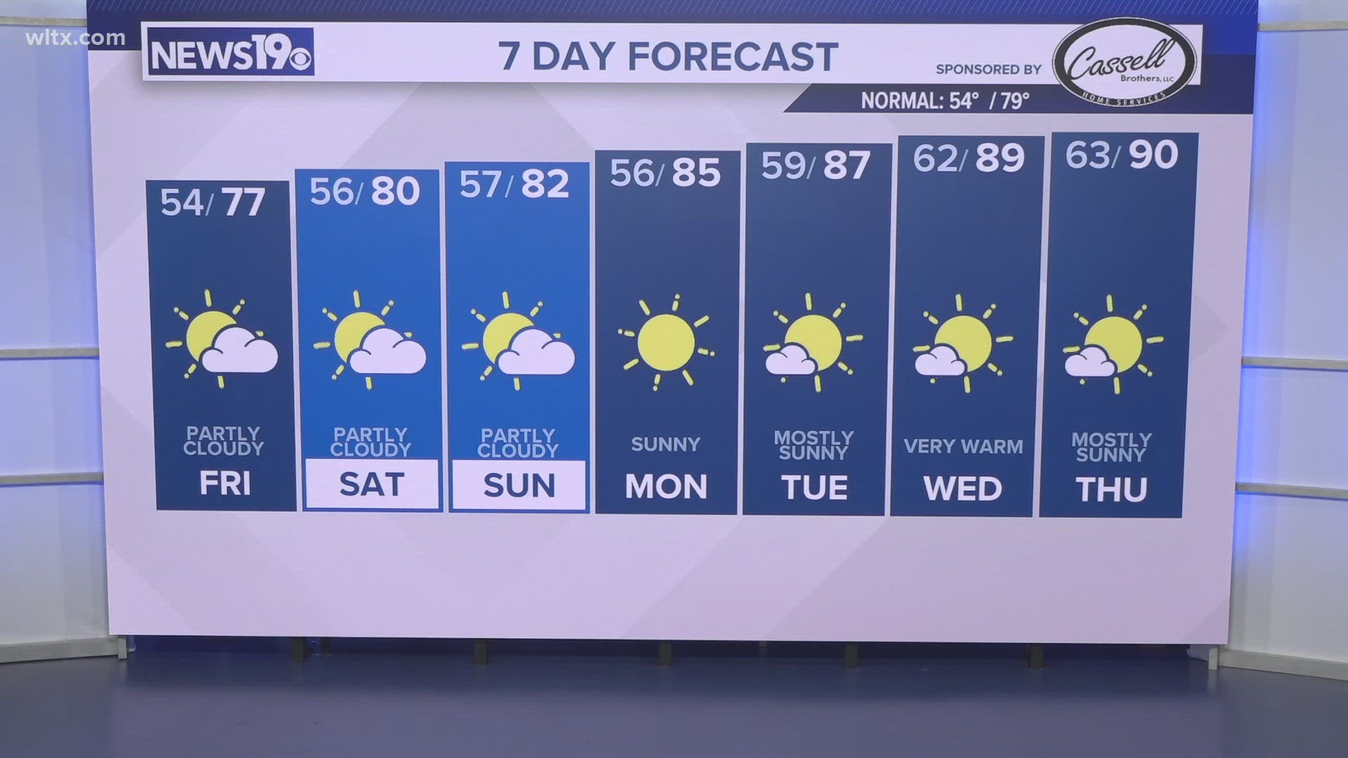
Sunday the low will begin to move north meaning the steady rain should move out of the area. Temperatures will be warmer as well but still below average for this time of the year. As of right now we have a 40% chance of scattered showers for that day.
Memorial Day will be a bit better with highs in the middle to upper 70s and we will have the chance of isolated storms but, overall things look much drier than the weekend.