

COLUMBIA, S.C. — The chance of severe weather will decrease as we go through the morning hours, but high winds may be an issue for the area early today.
Sunday night and early Monday morning were stormy for the Midlands. Heavy rainfall and a few strong storms impacted the Midlands. The Columbia airport reported 1.34” of rain Sunday.
A tornado warning was issued for parts of Orangeburg County early Monday morning, but a tornado has not been confirmed.
The threat of severe weather will continue to decrease, but winds will be increasing this morning. Earlier today, Augusta reported a gust of 56 mph. Aiken reported a wind gust of 52 mph.


A wind advisory is in effect for the Midlands through 11 a.m. today. Winds of 25 to 35 mph are expected, but winds could gust up to 50 mph.
Gusty winds could blow around unsecured objects. Tree limbs could be blown down and a few power outages may result. Isolated downed trees are possible due to saturated soils from recent rains. Use extra caution this morning when driving, especially if operating a high profile vehicle.
The strong winds should decrease by early this afternoon.
Temperatures will be noticeably cooler today. Daytime highs will likely top out in the lower 50s with under sunny to mostly sunny skies.

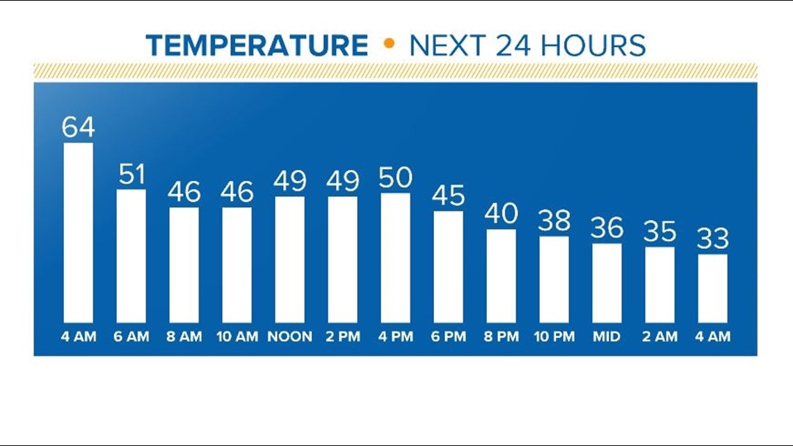
Tonight will be clear and cold. Low temperatures are forecasted to fall into the upper 20s by Tuesday morning.
Tuesday will be sunny and cool. Highs will be near 50 degrees. Temperatures will be close to normal Wednesday with highs in the middle 50s.