
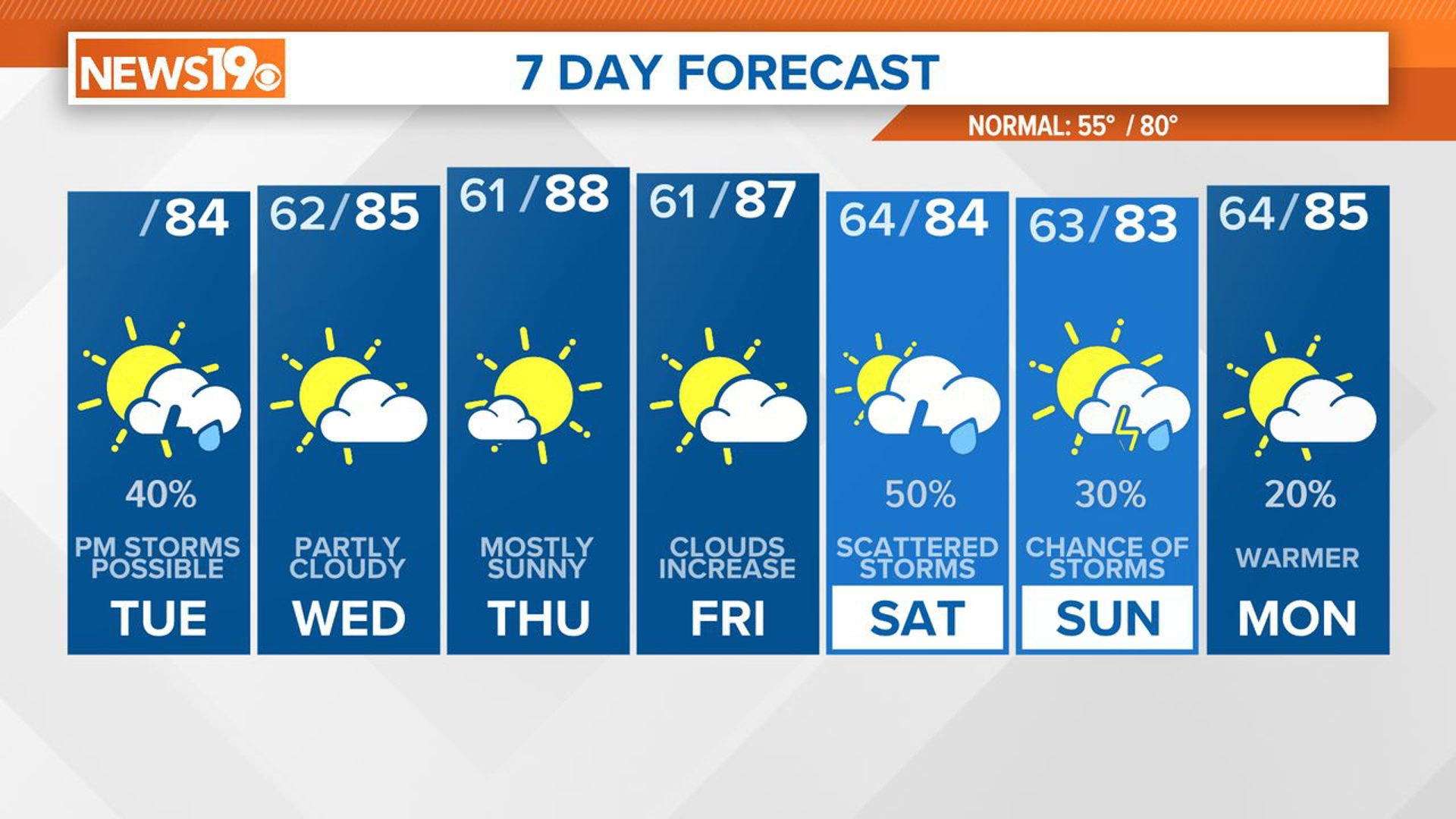
COLUMBIA, S.C. — A trough will move through the area today, leading to scattered showers and thunderstorms in the afternoon and evening hours. Following this, drier air will move in, promising clearer conditions for Wednesday and Thursday.
However, temperatures are forecast to rise once more, reaching the middle to upper 80s, as ridging develops in the upper atmosphere. By Friday, the chances of showers and storms are anticipated to gradually increase over the weekend, as low-level moisture returns, and a weak disturbance moves into the state.
The moisture will increase today ahead of the trough. Showers and storms are expected to develop in the afternoon hours. Our in-house forecast model brings rain to the eastern Midlands by 2 p.m. The showers and storms will move from west to east through the afternoon and evening. By midnight or during the very early morning hours of Wednesday, any rain should be out of the Midlands.

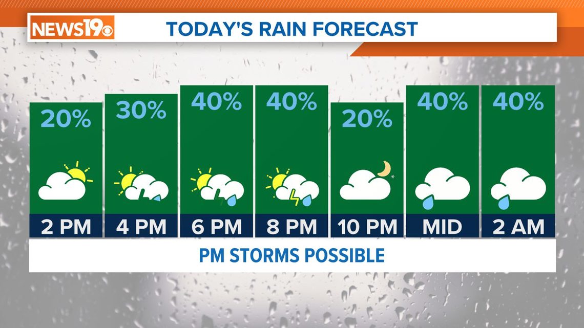
The chance of severe weather is low today and if any severe storms were to develop, they would be isolated in nature. High temperatures will be in the lower to middle 80s this afternoon.
Drier air will move into the area on Wednesday. There is only a small chance of a shower or storm along the coastal region of South Carolina.
Temperatures will be warming up into the upper 80s to near 90 degrees on Thursday and Friday. The chance of rain returns to the Midlands over the weekend.
The threat of severe weather is currently low over the weekend. Temperatures next week are forecast to be well above normal.