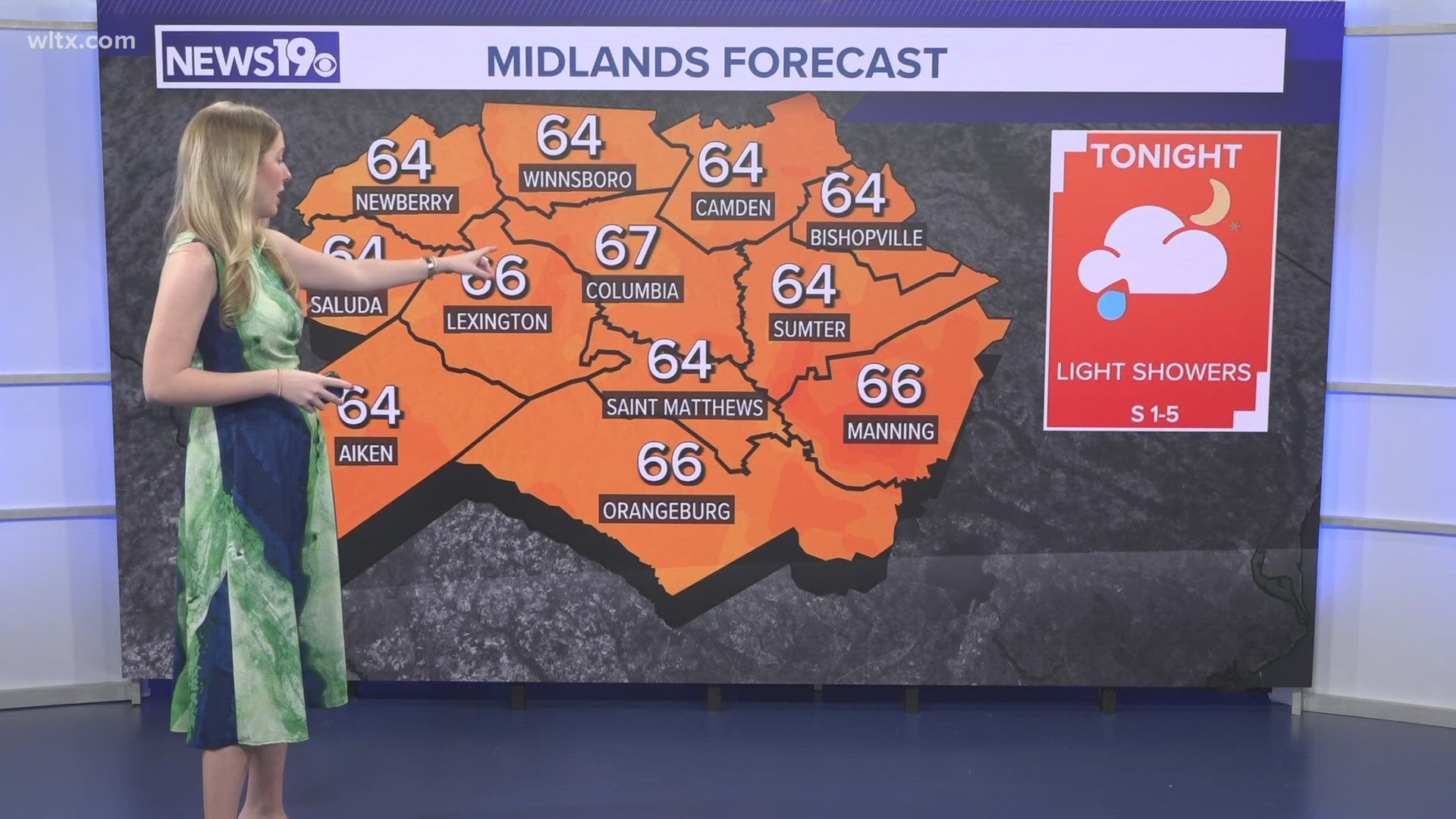
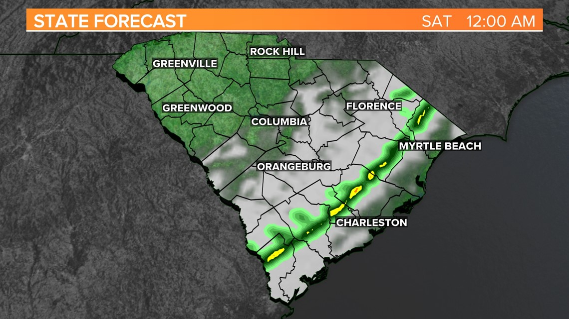
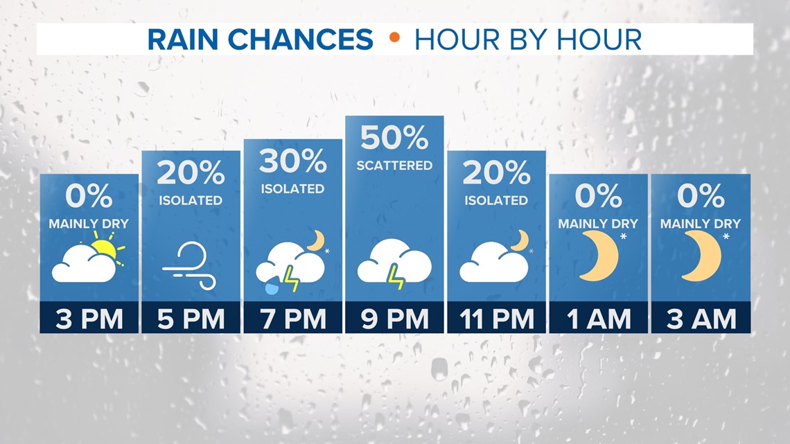
COLUMBIA, S.C. — A cold front is expected to move through the area today, bringing with it the possibility of showers, thunderstorms, and strong winds this evening and tonight. The weekend will be sunny and cooler.
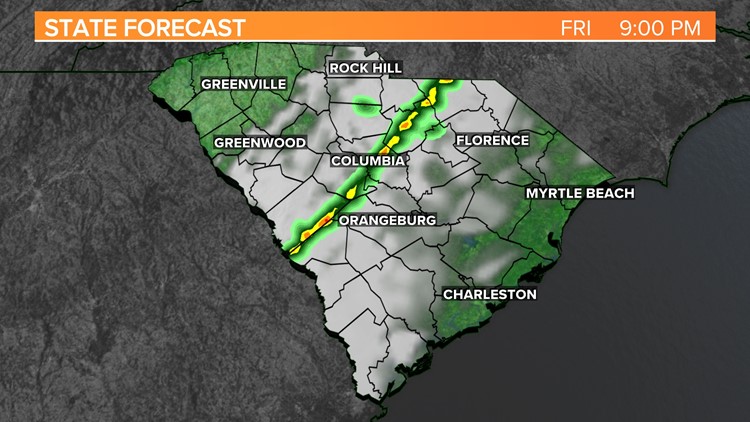
A complex scenario is unfolding today as low pressure moves from the western Gulf states northeastward while rapidly deepening. This will push a cold front across the South and into our area late this afternoon into this evening. The front will be weakening as it moves into the region, as the best dynamics will be well northwest of the area.
Even with the best dynamics outside the area, there will be some instability across the state. With dry air aloft, there is potential for the strong winds aloft to mix down, creating a damaging wind threat.

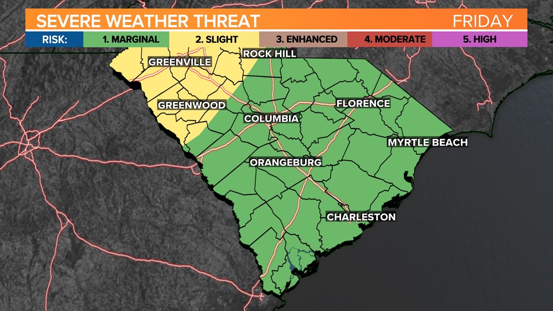
The Storm Prediction Center outlooks concurs with this, and the latest Day 1 outlook keeps the far western Midlands in a slight risk of severe weather with the remainder of the area in a marginal risk. The main threat with any strong or severe thunderstorm will be damaging wind gusts.
It will be a windy day regardless of thunderstorm development. Winds will be out of the south at 15 to 25 MPH with some stronger gusts this afternoon and this evening.

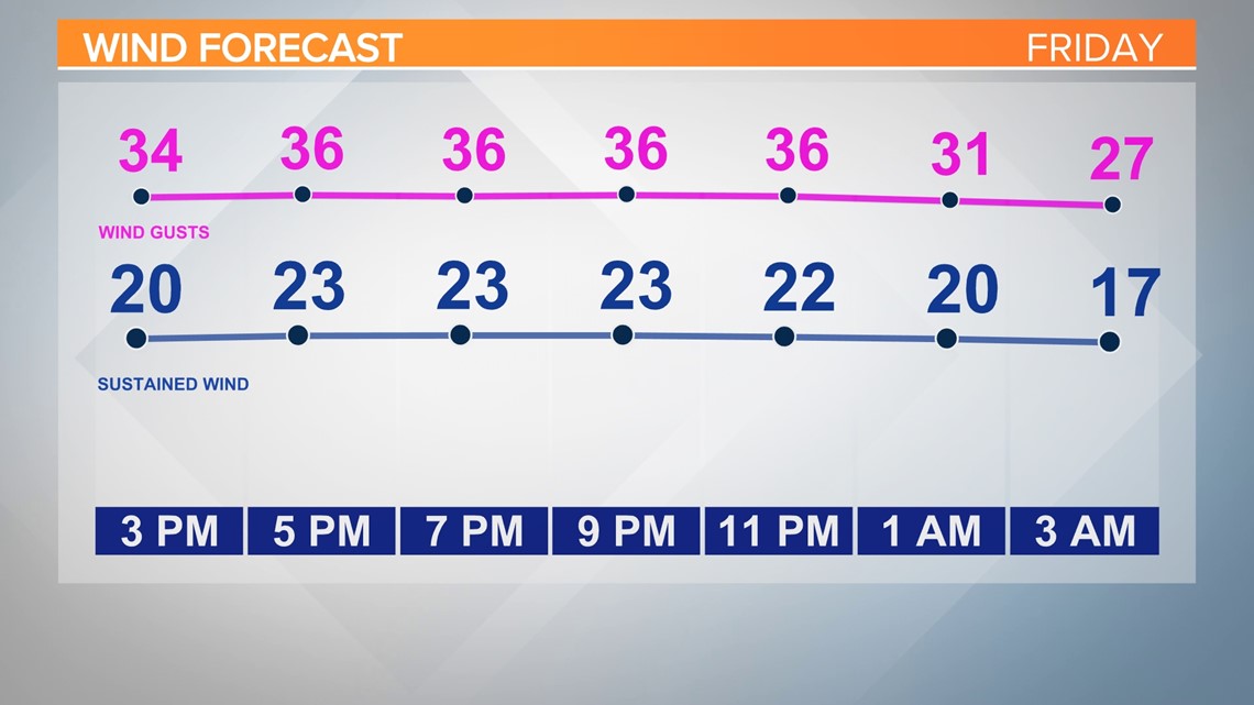
The cold front will move offshore late this evening into the early overnight hours, with drier air rapidly overtaking the area. Winds will begin subsiding behind the front, however, will remain gusty into Saturday morning. With the expected winds, the lake wind advisory remains in place from noon today through 7 am Saturday morning. High temperatures today will be in the upper 70s to low 80s, with lows tonight ranging from the low to middle 50s.

Drier air will quickly funnel into the area behind the cold front Saturday with clear skies. A lingering pressure gradient will be in place early with gusts to near 20 mph, but winds are expected to decrease through the day.
Downslope flow will keep temperatures above average with highs mainly in the low to mid-70s. High pressure will move into the area late Saturday into Saturday night with cold air advection developing overnight, with lows in the low to mid-40s.
As cold air advection continues into Sunday, blended guidance has limited spread for temperatures leading to higher confidence in highs in the upper 60s to near 70 degrees. Clear skies expected once again. Lows similar Sunday night to Saturday night.

Ensemble means continue to favor upper ridging strengthening into early next week, with temperatures rising to well above average once again. Otherwise, quiet weather is expected as the result of this ridging over the area along with surface high pressure in place.
High pressure will slowly shift offshore indicating that moisture will gradually increase, although deep moisture will likely be lacking.