COLUMBIA, S.C. — A cold front associated with the storms we experienced Sunday has ushered in cooler air for the start of our work week. Temperatures today will be about 15 to 20 degrees cooler than they were on Sunday thanks to a northerly flow and high pressure moving overhead.
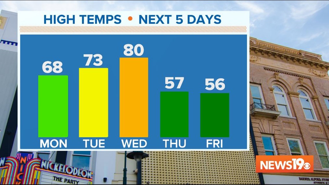
Skies will remain sunny throughout the day today with high temperatures in the mid to upper 60s.
We will be a bit warmer on Tuesday with lows in the low 40s and highs in the low 70s. A few more clouds will move in with an isolated chance for a shower late in the day as the front that moved through Sunday begins to lift north again as a warm front. However, most people will remain dry on Tuesday.
Wednesday will be even warmer as winds shift out of the south ahead of our next cold front. High temperatures will be near 80 degrees under partly cloudy skies.

By Wednesday evening, we will be tracking the cold front and a line of showers and storms that will move through the region.

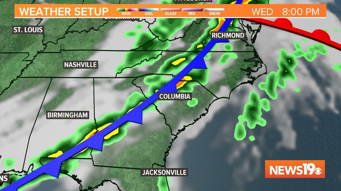
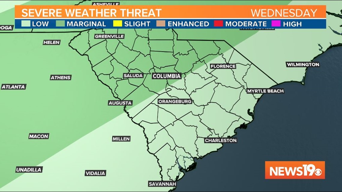
Areas north of I-20 are under a marginal risk of severe weather, which is a 1 out of 5 on the severe weather scale, so we will need to be weather aware for the possibility of an isolated strong to severe storm as the front passes. Strong winds would be our primary concern once again.

After the front passes, a Canadian high will move in and bring much cooler air for Easter weekend. Highs on Thursday and Friday will only be in the 50s. Low temperatures on Friday and Saturday morning will be in the low to mid 30s and we will need to watch tender plants for the possibility of a frost or freeze.