COLUMBIA, S.C. — Our Saturday is starting off warm and muggy across the Midlands. Low temperatures only dropped to near 60 degrees overnight with dew points also near 60.
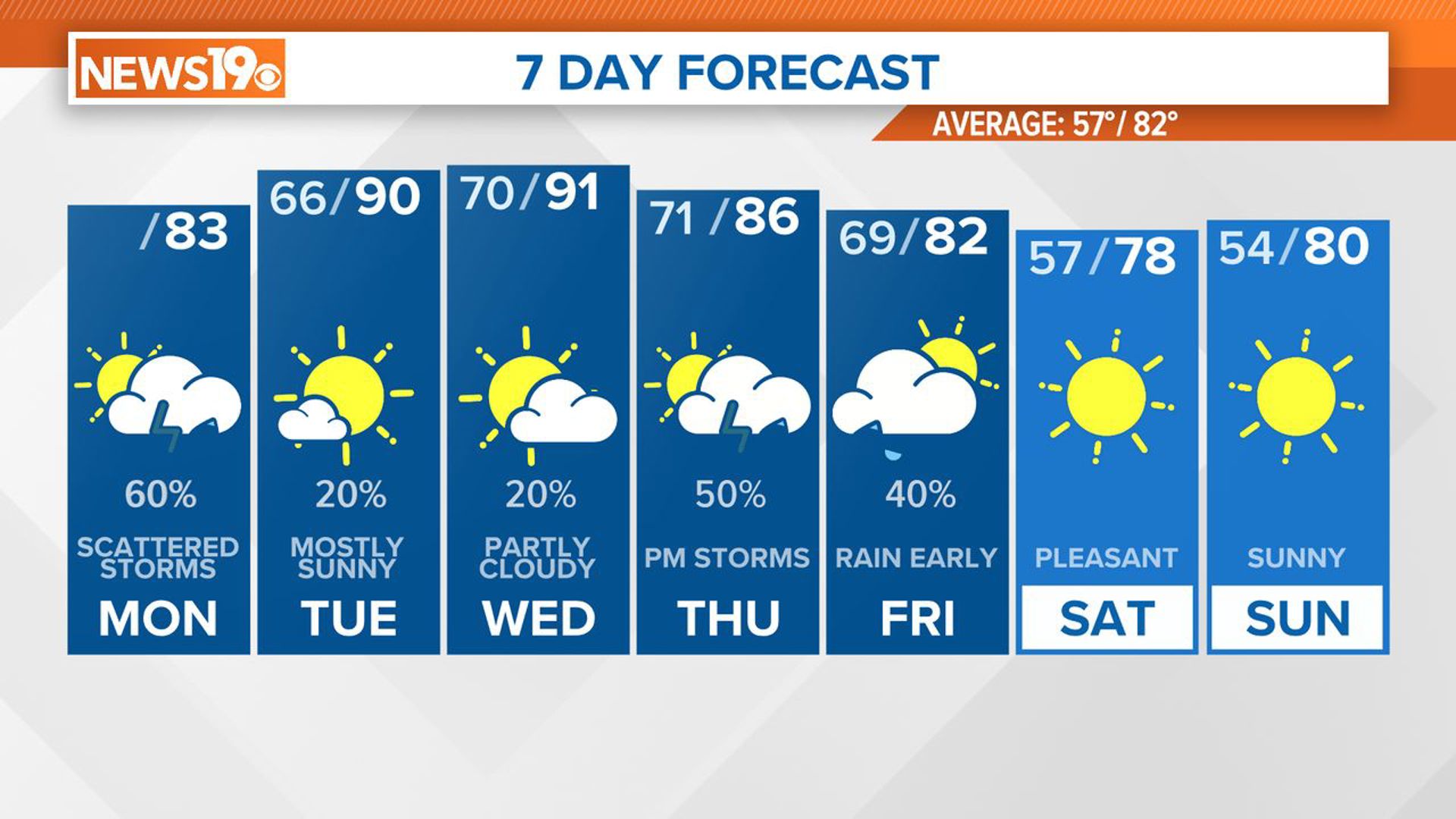
We're tracking unsettled weather for the start of the weekend with a few isolated showers popping up this morning and this afternoon ahead of a line of storms later this evening. Temperatures will remain mild today with highs near 80 degrees with muggy conditions. Skies will remain mostly cloudy.
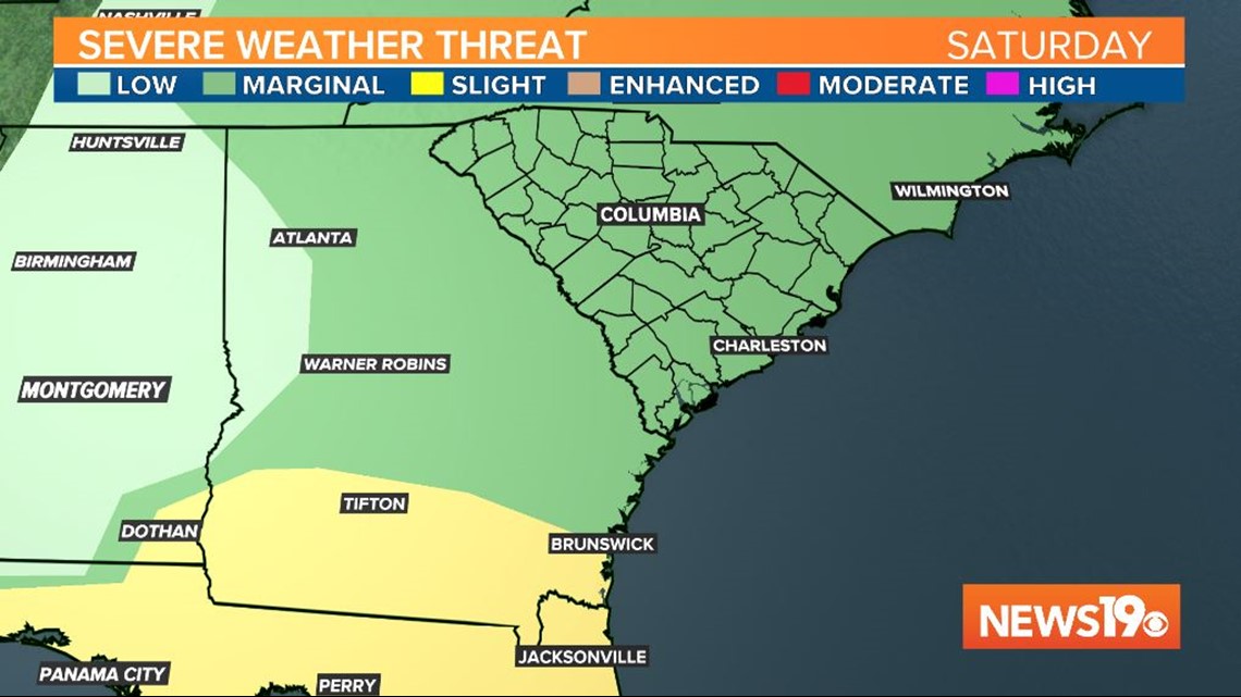
By late this afternoon and this evening we will be watching as a line of storms moves in from the west. The storms will move through the Midlands from west to east from 3 pm to around 10 pm.


The entire Midlands are under a marginal risk for severe weather, which is a 1 out of 5 on the severity scale from the Storm Prediction Center. If a storm does become strong or severe, damaging winds will be our primary concern with some small hail also possible.
There is a greater risk for severe weather in southern Georgia and Florida where a slight risk is in place.

An isolated shower is possible into Sunday, but overall the day will be much nicer. It will be breezy and warm and muggy once again with lows near 60° and highs in the upper 70s to near 80°.
Dry and warm weather will remain for the start of the work week with highs back in the mid 80s Monday, Tuesday, and Wednesday. The next chance for rainfall will come at the end of next week.