COLUMBIA, S.C. — A mix of ice and snow is coming toward the Midlands of South Carolina today through Saturday morning, a combination that could make for a few trouble spots along roads in the area--and may give some people something pretty to look at.
Download the free WLTX app for the latest weather on your mobile device.
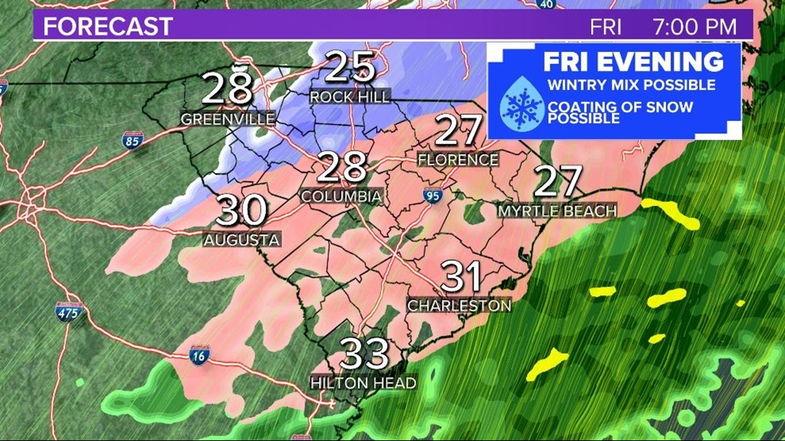
Spotty wintry precipitation on Friday could create slippery conditions in spots. Limited accumulations are expected, but travel impacts are possible. Meanwhile, cold temperatures will arrive throughout the day on Friday. Afternoon temperatures will stay near 30 degrees Fahrenheit and wind chills will remain in the 20s.
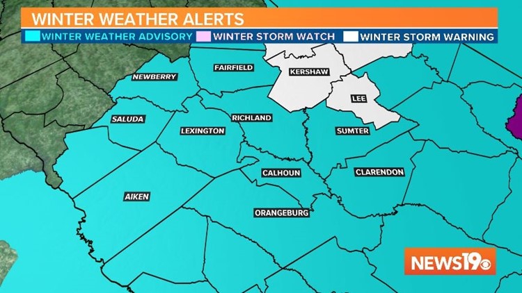
The National Weather Service has issued a Winter Weather Advisory from Friday morning into early Saturday morning for most of the Midlands. A wintry mix of freezing drizzle with some sleet or snow are possible on and off Friday afternoon into the overnight hours.
Friday morning, the National Weather Service issued a Winter Storm Warning for Kershaw and Lee counties.
Heavy mixed precipitation with snow accumulations of around two inches and ice accumulations of around one tenth of an inch is possible in the warning area.


What to expect
Minor accumulations of ice or snow could create slippery conditions in spots on Friday from the late morning into the evening. The greatest risk will be in communities toward the north and east.

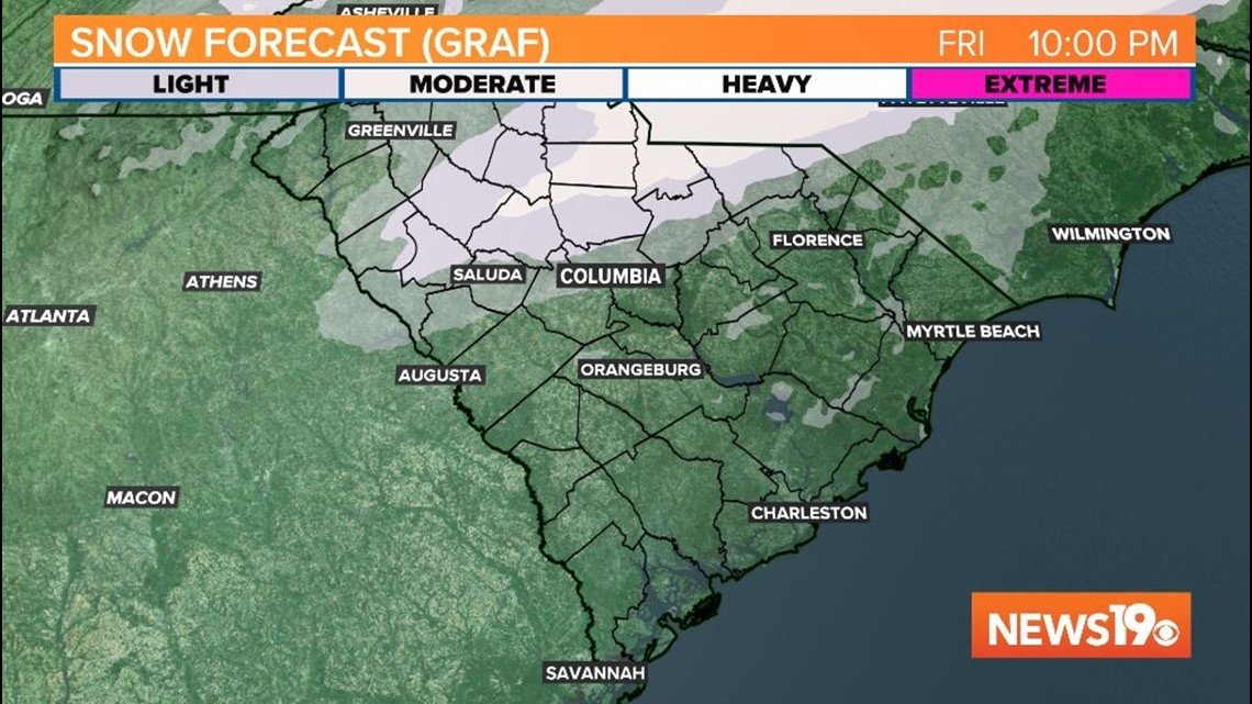

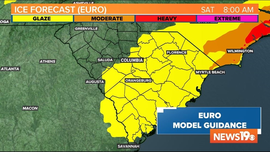
Ice accumulations near the I-95 corridor could reach 0.10" which could damage trees, create power outages, and produce slippery conditions. In the central and western Midlands, dry air should keep ice accumulations low enough to limit major travel issues, but roads may still become slippery for a period of time on Friday afternoon or evening. Snow or sleet may mix in on Friday afternoon or evening. Little to no snow accumulations expected for most of the area, but snow may reach 1" farther north and east.
Timing
Precipitation will become spotty on Friday morning as dry and cold air moves in. Little to no precipitation is expected early in the day on Friday for the western or central midlands, but some rain or freezing rain is possible farther to the east.

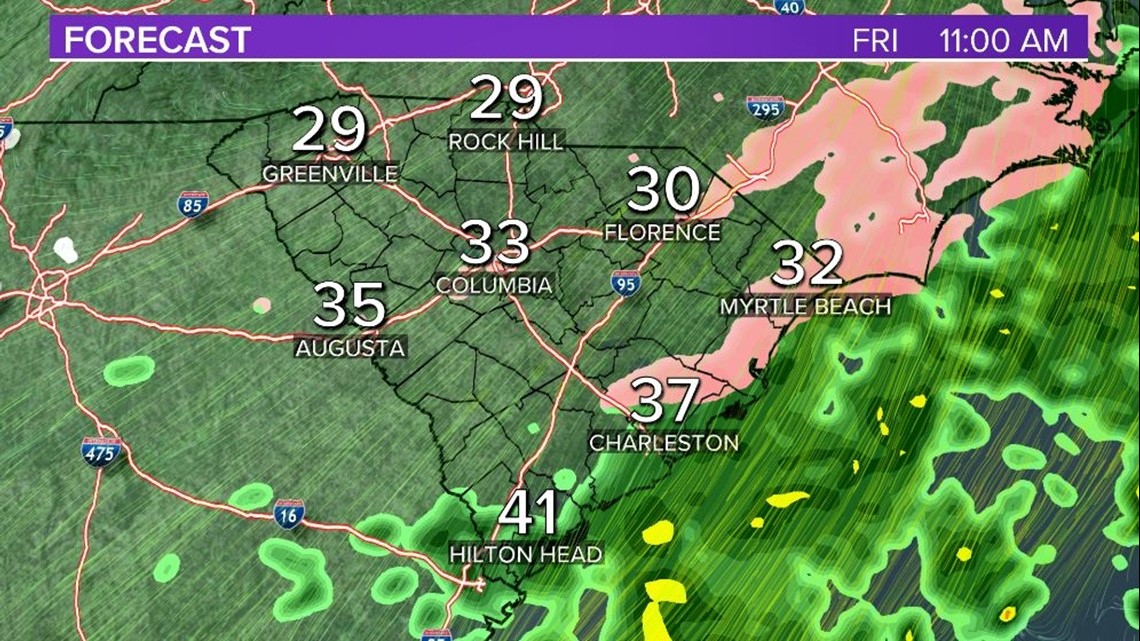
Temperatures will drop below freezing by mid-morning on Friday or in the early afternoon. Any precipitation that falls could create slippery conditions.
A brief burst of snow flurries, freezing drizzle, or sleet is possible late Friday afternoon or overnight. A coating of snow or ice may create tricky travel conditions. Temperatures late Friday into Saturday morning will be in the teens, but a north breeze will drop wind chill values into the lower teens for Saturday morning.

There is a lingering chance for some light precipitation on Saturday or Sunday. Temperatures will be cold enough for some snow flurries or sleet for the weekend. Otherwise the weekend will have a mix of sun and clouds with high temperatures running nearly 20 degrees below average - and struggling to reach 40F.